Thunderstorms possible in Seattle on Saturday, then comes heat for the inaugural World Cup match?
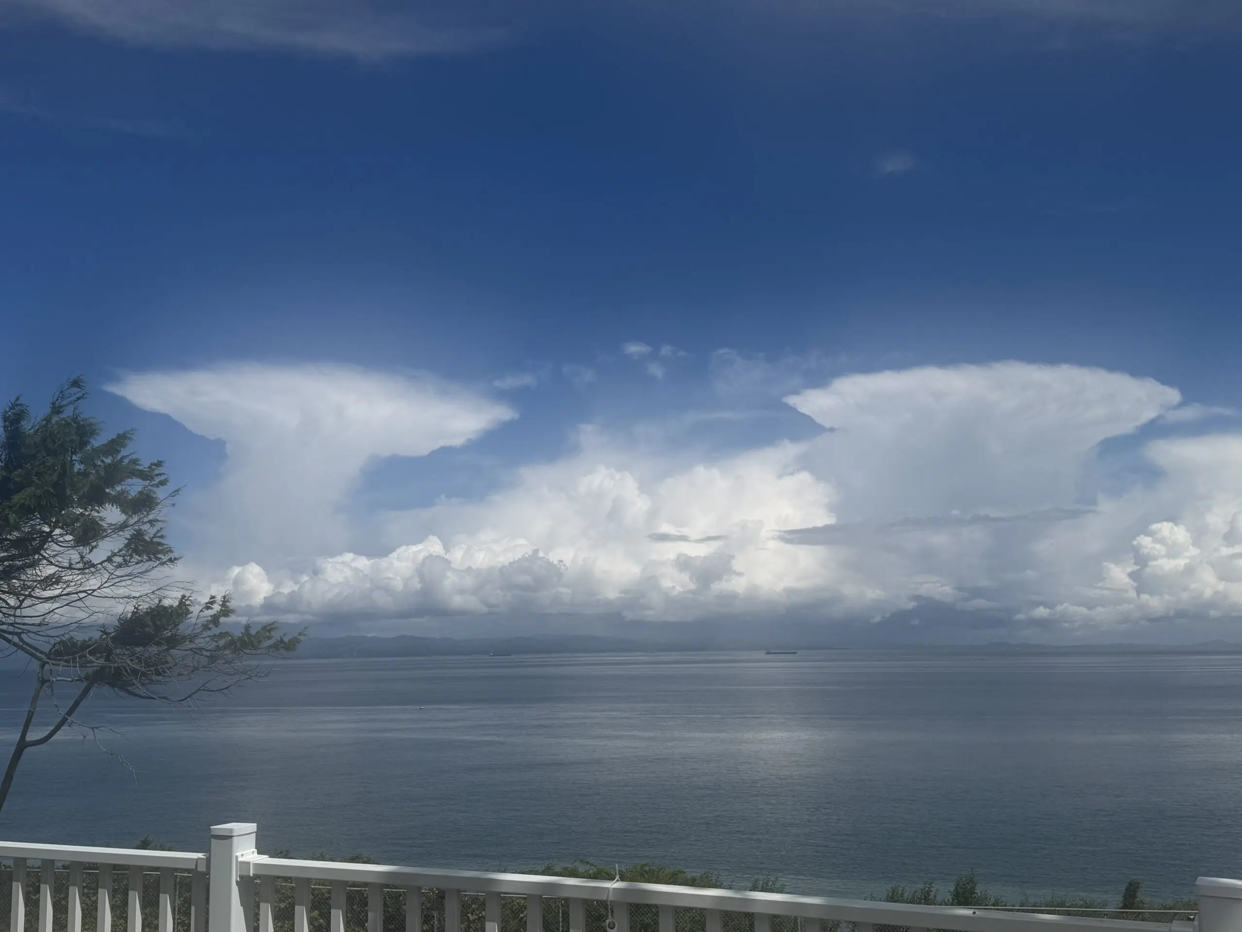
Cumulonimbus clouds with flat-top anvils over Vancouver Island on June 6, 2026. (Photo: Rick Sistek)
If you’ve ever wanted to get insider information on the best time to start a game of weather bingo, these next couple weeks is your best bet, as we’re about to run the gamut again from chilly rains and thunderstorms to at least some inklings of a heat wave looming in the middle of the month :O
But first, the cold and the rain. A strong area of low pressure that is currently swirling in the Gulf of Alaska has our name on it. (well, not literally. Unless your name is “L”.)
It will approach the coast on Friday, getting close enough to toss a few showers into Western Washington, and there is even a low risk of thunderstorms Friday afternoon, but mainly in the Northwest Interior and Olympics as the instability won’t quite reach the Puget Sound area in time to take advantage of the day’s heating.
For Seattle, just expect some scattered showers after lunch, though some may have a decent burst of rain with them. Highs will stay in the low 60s.
WATCH FOR THUNDERSTORMS ON SATURDAY
Saturday is looking at quite an active weather day as that big low pressure center slides right over western Washington, providing cool, unstable air, born of the Gulf of Alaska that should trigger some scattered thunderstorms.
Just about all areas — including the Seattle and Puget Sound area — could see a few passing thunderstorms during the day, starting as early as late Saturday morning and lasting well into the evening. These storms will be moving generally west-to-east so it’s the western horizons you’ll want to watch.
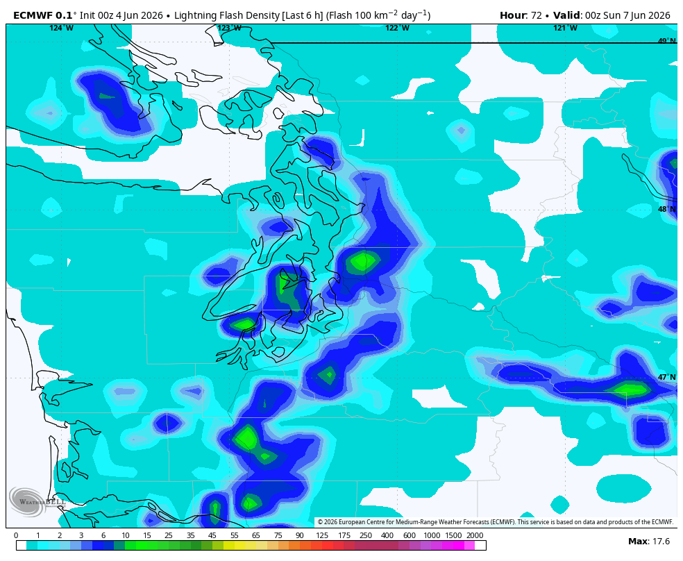
The storms don’t look severe; these should be on par with what passes for “usual” Seattle thunderstorms, but any lightning is dangerous, and I know a lot of people will want to be outside on a summer weekend and I think some proms are this weekend too. But it’ll be time to head back inside at the first rumbles of thunder and hit the dance floor instead. Anyone camping or hiking in the mountains also needs to be very weather aware Saturday.
In addition, any storms could bring bursts of heavy rain, gusty winds and some hail. Highs will only reach the mid-upper 50s.
The showers and storms in general will taper off Saturday night, with the exception of the Puget Sound Convergence Zone area in the North Sound, where rain may last through the night with a lingering chance of lightning.
If you can, hold off on any outdoor weekend plans until Sunday, which will be a brief break in the rain (what? There’s more?). It won’t be the sunniest or warmest day in June — highs will still be in the 60s and let’s call it mostly cloudy — but it should be a lot drier; though still a risk of a passing shower.
Another weaker weather system comes in on Monday for a fresh round of light showers and a slight risk of a thunderstorm – much lower than the weekend though. Showers last through Tuesday and even into early Wednesday morning before we start to dry out for the rest of the week.
WOW THAT’S A REALLY COLD AND RAINY FORECAST. WHAT IF I WANT HEAT.. I TOTALLY WON’T REGRET ASKING THIS, RIGHT?
Ummm…
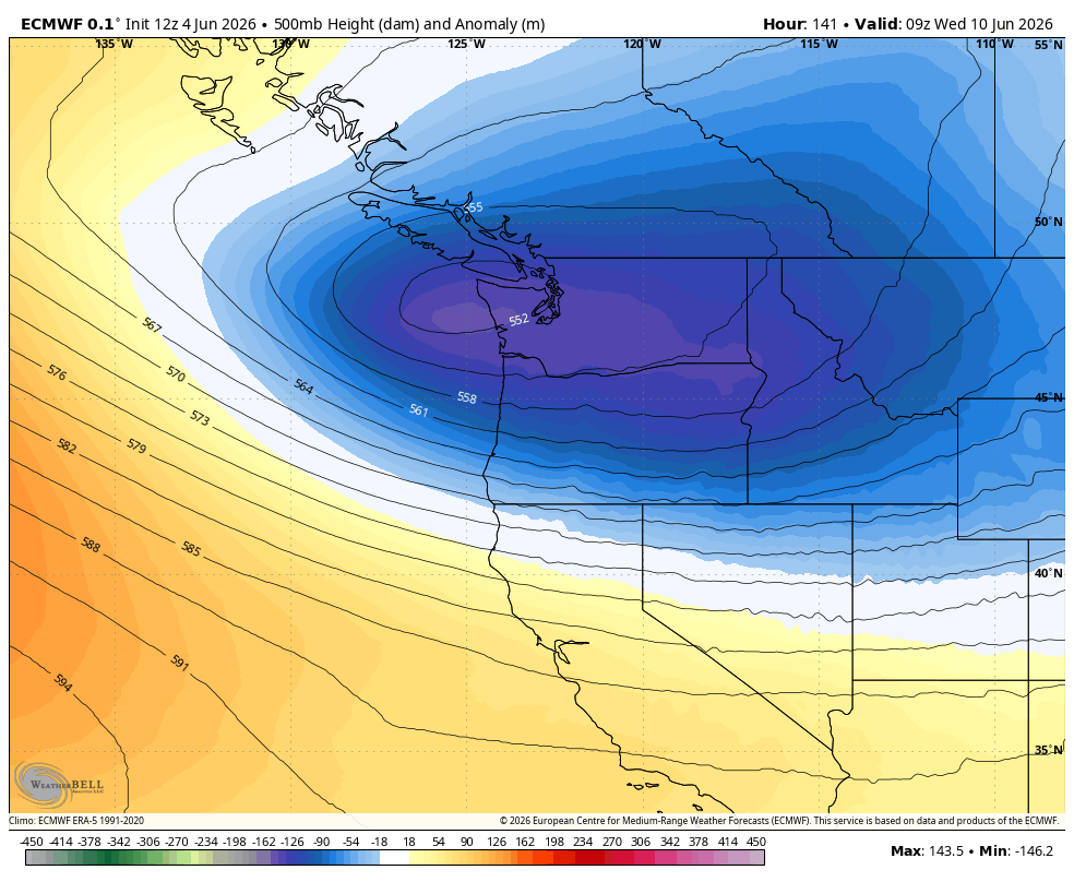
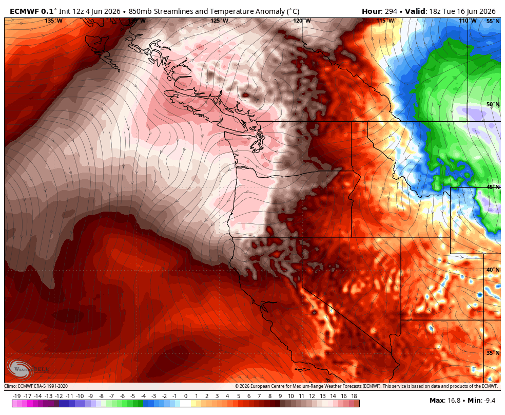
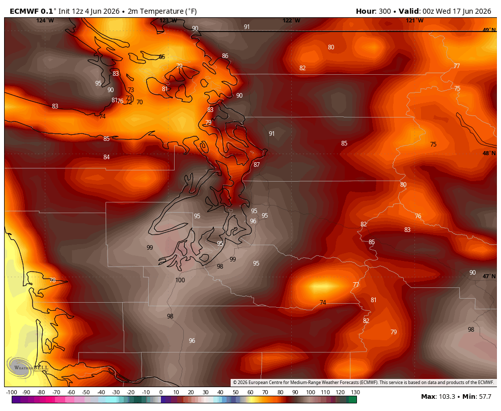
So you may have already heard inklings about some potential heat looming in the far long range forecast. The European model is picking up a signal of a strong ridge of high pressure with our name on it (well, not literally. Unless your name is “H”…) due to move into the Pacific Northwest around the June 15th time frame.
The initial runs are indicating a heated air mass of about a +25 degree F anomaly, and average highs are in the low 70s in mid June so do the math and…. Yeah. IF it verifies like that.
Then again, if I had a dollar for every time we had an arctic blast and/or snowstorm shown on Day 10-11 model in the winter around here… I’d probably have a neat studio like Ryan Hall Y’all instead of just this rambling text setup.
Then again-then again, trying to get snow in Seattle is like trying to throw a football through an inner tube, while forecasting heat is like trying to throw a football between the goal posts — the weather patterns are a lot more forgiving.

We’ve got plenty of time to watch this pattern unfold, but consider this your early heads up that there are some signs of our first heat wave of the year in mid-June.
HEADS UP, WORLD CUP FANS!
Monday, June 15 also happens to be the first World Cup match for Seattle (Belgium vs. Egypt) — at noon, no less :O. So I hope the City of Seattle is at least taking advantage of this extra time to start planning on what happens when we have tens of thousands of people outside in potential 90 or 95+ degree heat all day. (At least the humidity would be low.) The climate is probably right at home for Egypt but Belgium may not be thrilled.
So far it looks like the heat should abate by the middle of that week, so hopefully more Seattle-esque summer weather for the USA match on that Friday.
MORE TO EXPLORE:
- Seattle forecast to endure its 14th-consecutive hotter-than-average summer
- ‘Historically’ hot summer in the Northwest? Don’t believe the hype