Thunderstorms possible around Seattle and Puget Sound area again Saturday
 Scott Sistek
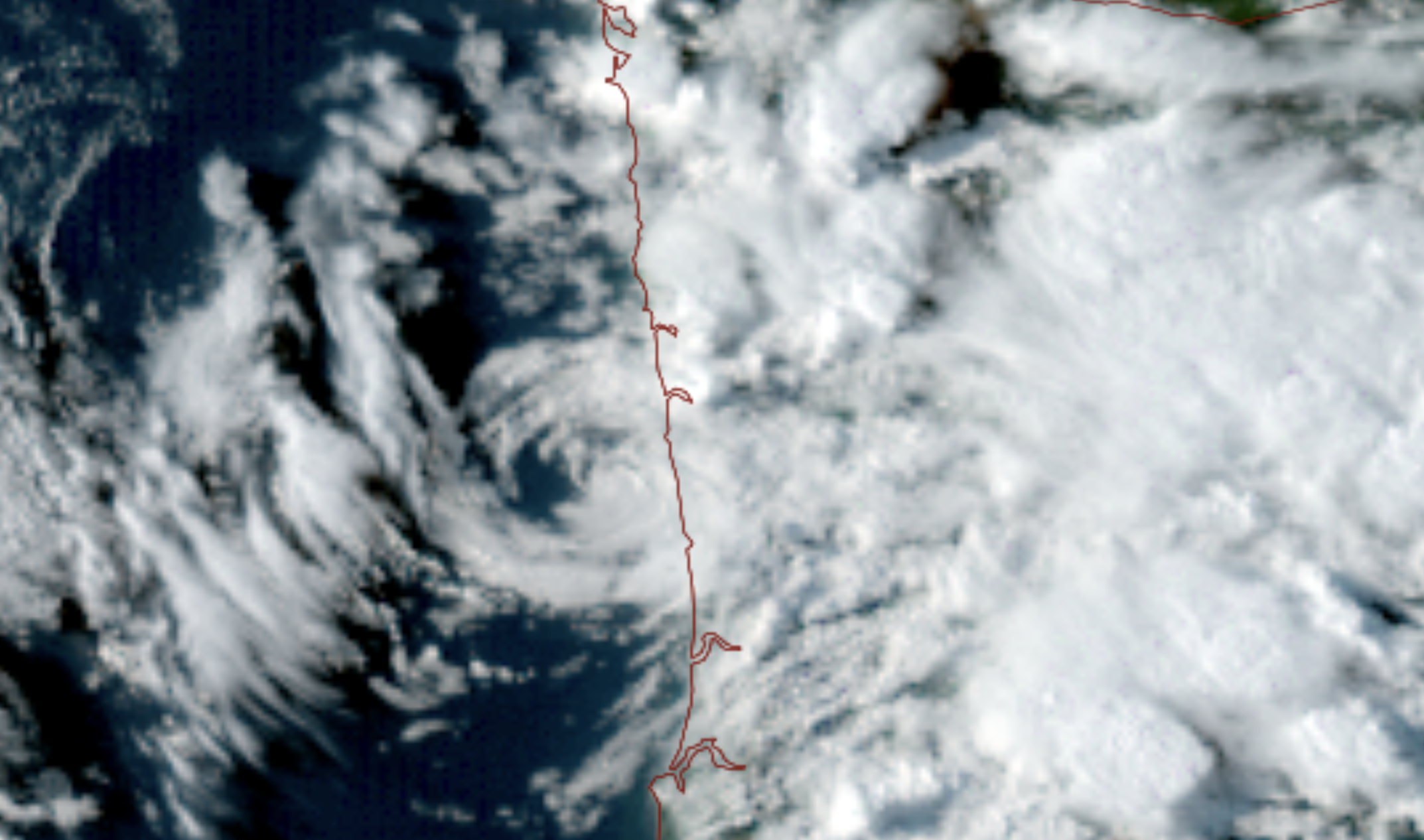
GOES 18 satellite image shows a low pressure center heading into the central Oregon coast as showers and thunderstorms erupt across the Northwest on Sept. 4, 2026 (NOAA / CIRA / RAAM-B)
Did you know that AAA named Seattle as No. 1 on its Top 10 travel destinations for this Labor Day Weekend?
Apparently word even made it to the atmosphere, because among the visitors and tourists in town this weekend will be an area of low pressure.
It’s already made its presence known from afar as it swirled just off the Oregon coast Friday evening — the satellite image was wild; it looked like the coast just south of Newport was getting hit by like a micro hurricane.
But even a state away, the low brought enough cool, unstable air to destabilize the atmosphere, and with the day’s sunshine providing some buoyant warmth and the Cascades providing some lift, we had a recipe for some thunderstorms to develop.
And develop they did. Mix in some southeasterly winds aloft rotating around the low pressure center, and those storms were then steered into the Cascade foothills and lowlands.
Storm in north King County just before it drenched the area and produced dozens of lightning strikes. #wawx pic.twitter.com/6PXWHez4QA
— David Lee (@WoodinvilleWX) September 5, 2026
One storm in particular developed over the Eastside and moved into the Bothell/Redmond area, where it brought large hail, strong winds and some frequent lightning.
The storm even showcased a rare-for-the-Seattle-area shelf cloud.
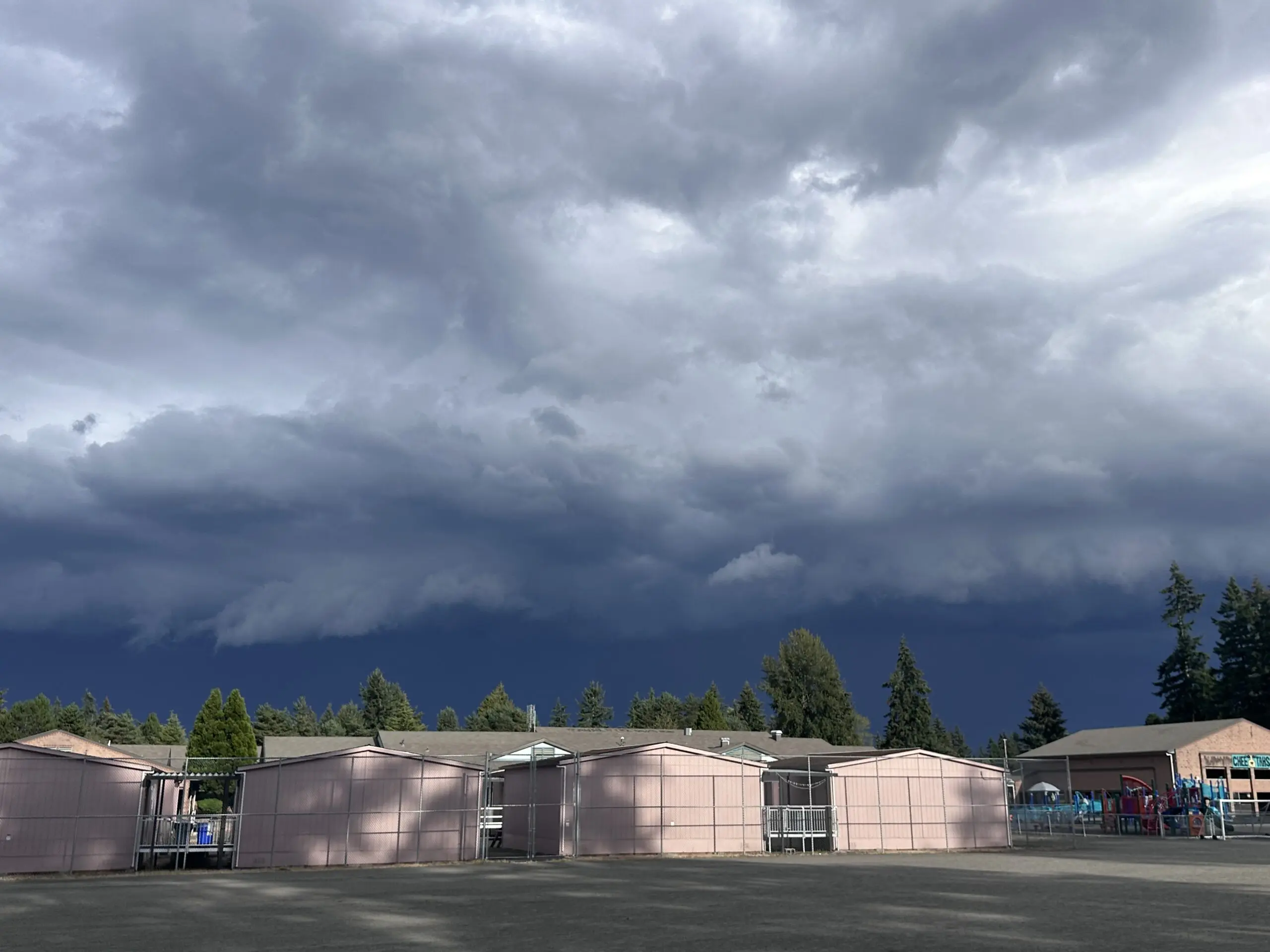
Thurston County was another storm winner.
Those storms were fading Friday night as daylight waned and the cells moved away from the lift-generating mountains.
PSYYYYYYYYYCH! ⛈️😭😭 pic.twitter.com/YWZxGXI2og
— Scott Sistek (@ScottSeattleWx) September 5, 2026
SNEAKY THUNDERSTORMS AGAIN FOR SATURDAY
But if you missed out, or thought that was an entertaining show… how about we try for an encore on Saturday?
Mr. Swirley Low (TOTALLY an official meteorological term, btw…), after making “landfall” on the Oregon coast, is set to slowly move across Oregon to the east/northeast and somewhat closer to the Seattle/Western Washington area on Saturday.
This will reset a similar pattern to Friday: Sunny start to the day provides the warmth, the mountains provide the lift, the east/southeast upper level winds push the storms off the mountains and foothills into the I-5/405 corridors and here we go again.
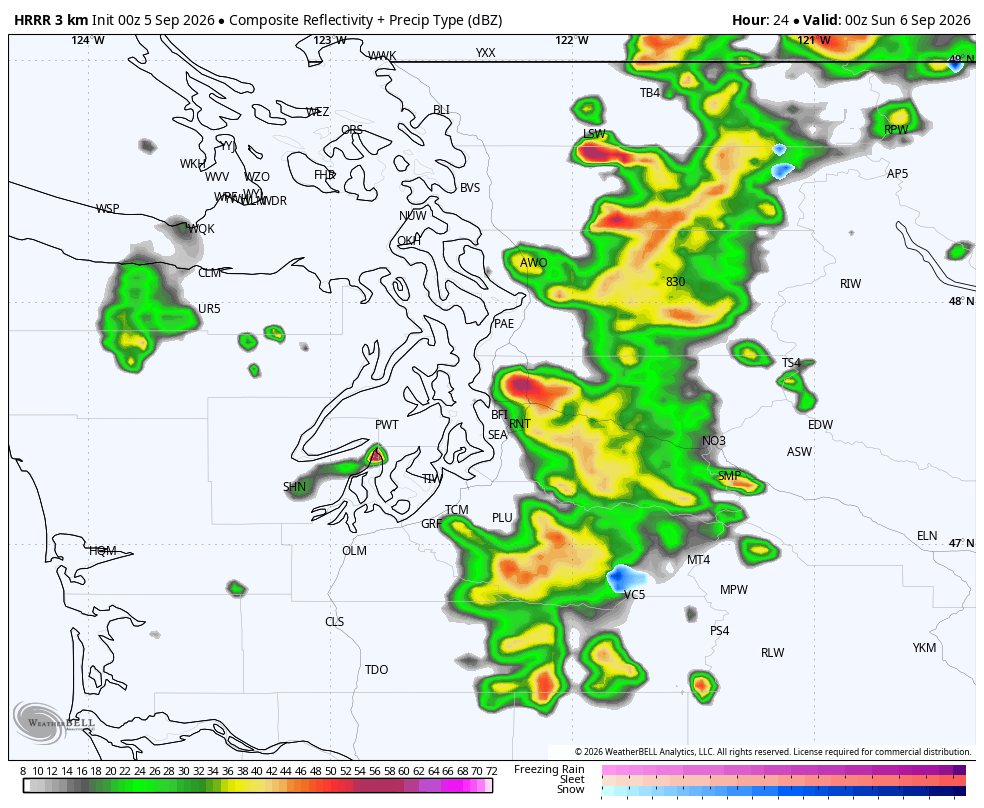
The short range forecast models are indeed again showing another round of thunderstorms developing over the Cascades and foothills Saturday afternoon and then moving west over the eastern Puget Sound area.
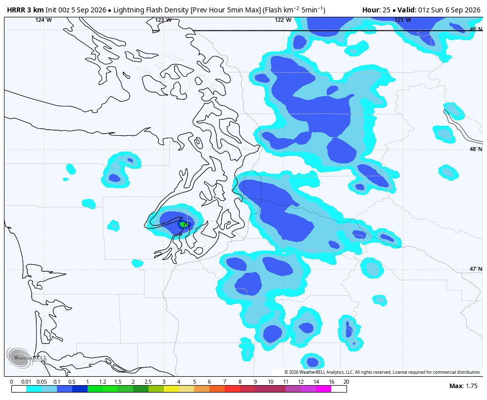
They’ll likely once again start to lose power off the mountains but with the low center closer it should provide some extra lift. In that sense, some of these storms Saturday could also be a bit more potent and lightning may be more widespread than Friday, especially in King and Snohomish Counties. But all areas of Western Washington could see thunderstorms in the afternoon and evening.
But like Friday, we’ll see plenty of sunshine between the storms. If you can dodge the storms, it’ll be a nice start to the weekend but any outdoor plans really need to keep eyes to the skies and the radar. These storms develop pretty quick.
Mr. Low will gradually weaken through Saturday and into Sunday as it drifts into Eastern Washington (bringing scattered thunderstorms there :/ ) .
SURE, FLORIDA HAS DISNEY WORLD, BUT….
There is still a lingering risk of afternoon and evening showers and thunderstorms Sunday but with the low weaker and less powerful, it may only have enough oomph to bring storms to the mountains.
That means a sunnier, calmer day for the lowlands Sunday. (Take THAT, No. 2 travel destination Orlando and your tropically infused thunderstorms this weekend while it’s 93 with 4354% humidity and a heat index of approximately 7 billion…)
Thunderstorm threat is done over here on Monday which will be mostly sunny and highs near 71. (Take THAT, No. 3 Boston and your…well, OK the weather actually looks pretty nice in Boston this weekend too… But at least our baseball te….oh. But at least our FOOTBALL team is better…and so are our doughnuts!)
A brief ridge of high pressure will get things back to summer(ish) normal for the middle of the week, just in time for said local football team to remind said No. 3-area football team who reigns supreme right now. Highs will reach the mid-upper 70s on Wednesday and Thursday.
Long range models do indicate another low may decide to visit the Seattle area next weekend. Maybe the flights were cheaper?!?
MORE TO EXPLORE:
- Strong thunderstorms bring rare ‘shelf clouds’ to Seattle area
- Stunning view of swirling low pressure center that has eyes on Seattle area
- What are some scenarios a historic ‘Super El Nino’ could present for the Pacific Northwest and California?