Thunderstorms in Seattle Saturday may be nature’s unwanted weekend morning alarm clock
 Scott Sistek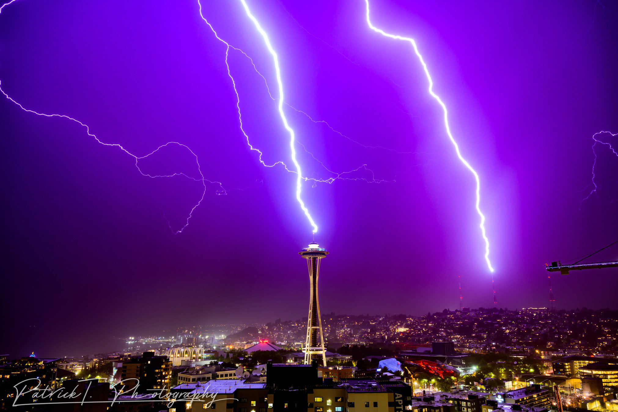
Courtesy: Patrick T Photography
Seattle may finally get its first measurable rain of the month Saturday — three weeks into it — but it’s coming with a cost that may be more harm than benefit: Lightning.
It’s not so much the lightning potential around Seattle — though there is certainly some, and I’m sure that many were hoping this recent pleasant stretch of weather would hold a few more days as summer weekends wane. But there is even greater risk of lightning across the Olympics, Cascades and a wide swath of Central and Eastern Washington, making for dangerous wildfire conditions.
I’ll start with the Western Washington lowlands update, but don’t worry I’ll get to cover you all east of the Cascades too…
WESTERN WASHINGTON: IT’S NATURE’S UNWANTED SATURDAY MORNING ALARM CLOCK
I know, many of you just finished a long week and hoped to sleep in Saturday*, and instead, there’s ruckus outside.
(*Shout out to my fellow weekend work warriors who still set regular alarms Saturday mornings…)
A swirling upper level low center that was offshore on Friday will swirl into southwestern Washington overnight Friday, pushing across the Puget Sound and Western Washington early Saturday morning, then exiting out the North Sound and the Northwest Interior into southern B.C. by Saturday afternoon.
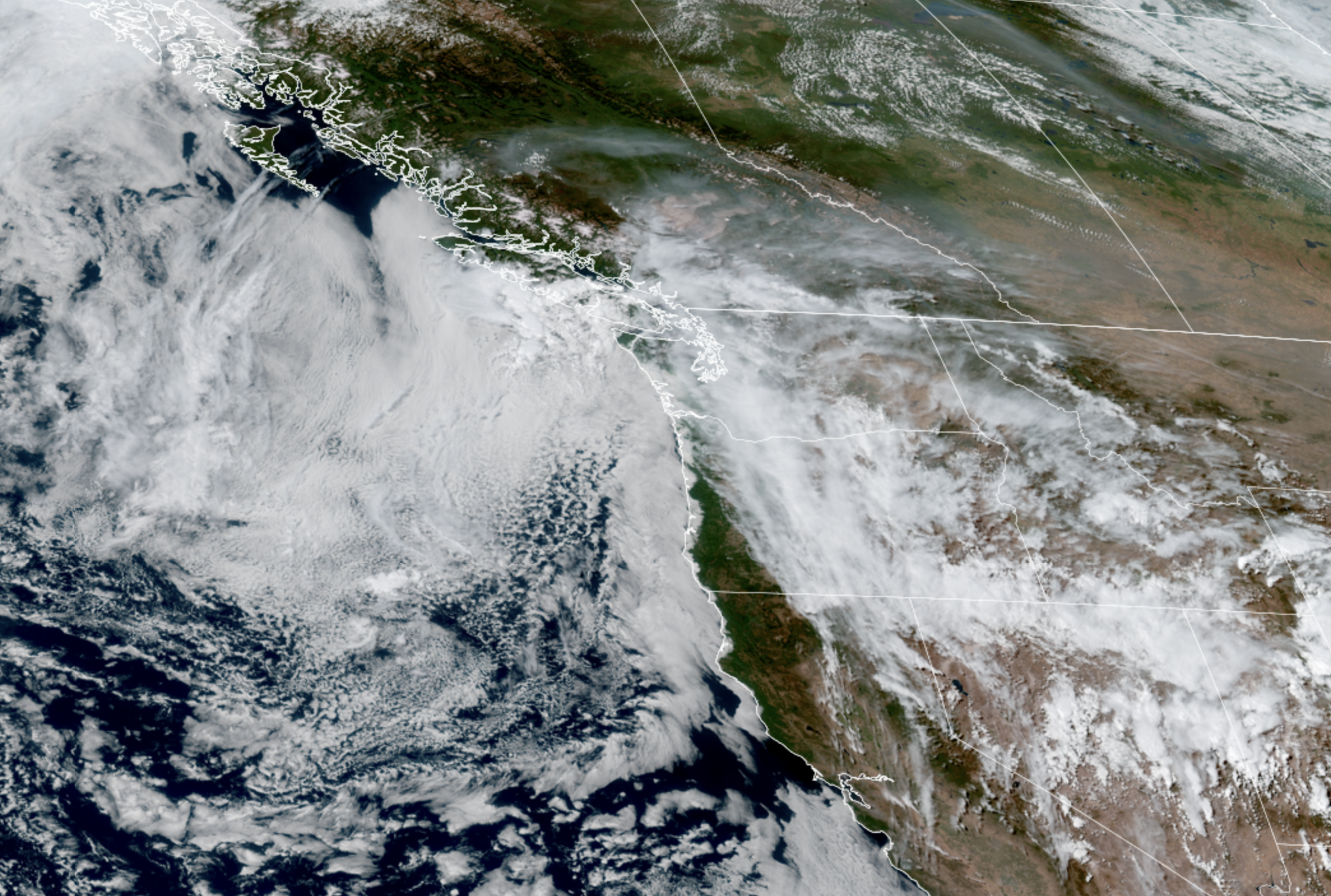
This low will carry quite a bit of unstable air, and with the lingering heat of the past couple days and the mountains helping provide lift, we’ve got a recipe for not just showers, but thunderstorms.
WHERE? All areas in Western Washington have a chance of scattered thunderstorms and lightning Saturday, including the main Seattle and Puget Sound metro area.
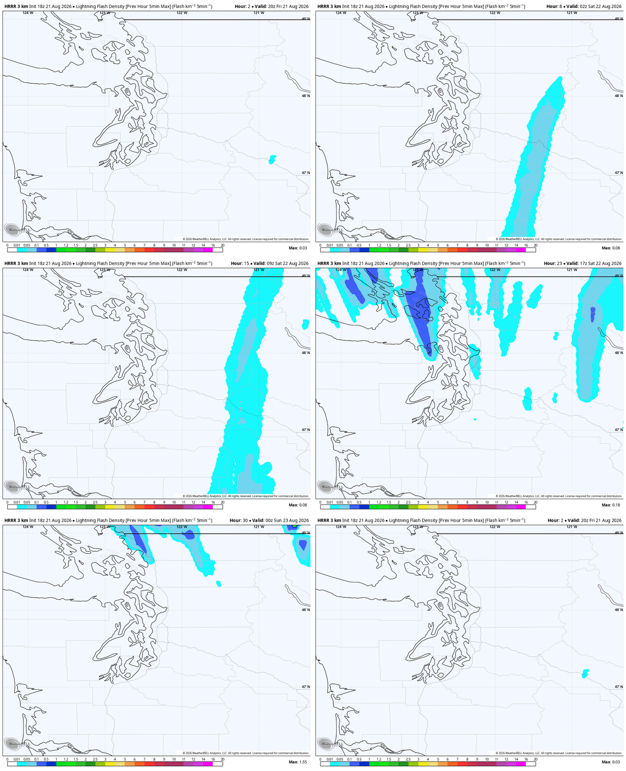
But the models seem to favor greater coverage along southwestern Washington and the Kitsap Peninsula/Olympic Peninsula (essentially, west of Puget Sound) and then up in the North Sound/Northwest Interior (think, north of Everett) as we get later in the morning and into the afternoon as the low moves north but again, all areas are under threat of storms.
In the Cascades and Olympics, Fire Weather Warnings (aka “Red Flag Warnings”) are in effect due to combination of potential lightning on dry fuels, plus the thunderstorms can bring sudden and erratic “outflow” winds that can quickly fan flames in unpredictable directions on any new or existing fires.
WHEN? Thunderstorms will begin in the Cascades and southwestern coast as soon as overnight Friday night. The lowlands look to start seeing lightning around 3-4 a.m. in the South Sound, then into the Central Sound about 4-6 a.m, moving generally south to north from there.
Activity looks to taper off south of Tacoma by about 8-10 a.m. but scattered storms look to linger from about the Seattle/Central Sound area north to the Canadian border through the morning and even into the afternoon, especially the farther north you are.
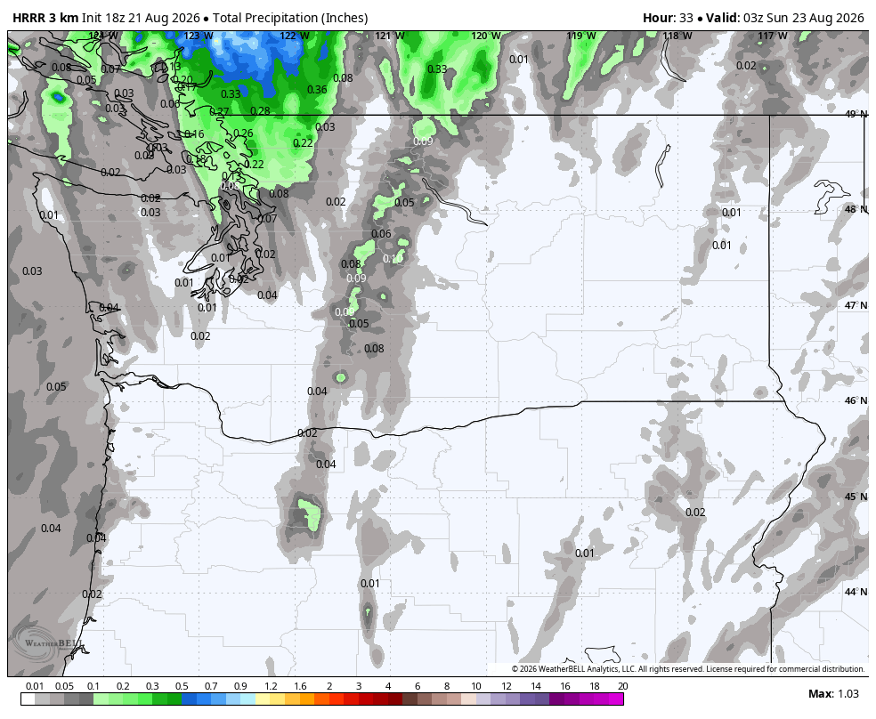
Aside from the lightning, we’re expecting at least some rain from these cells. Not gobs but perhaps enough to at least wet the ground. Otherwise it’ll be much cooler and cloudier with highs closer to 70. (If Seattle doesn’t get to 70, it’ll the first time since July 16!)
All lightning activity should end by Saturday night but showers may linger in the North Sound into Sunday morning.
EASTERN WASHINGTON: MUCH MORE LIGHTNING; NOT MUCH RAIN
The lightning isn’t great for the west side, but it’s REALLY not great for the east side where of course it’s still tinder dry and wildfires are still burning — and they don’t need any more company.
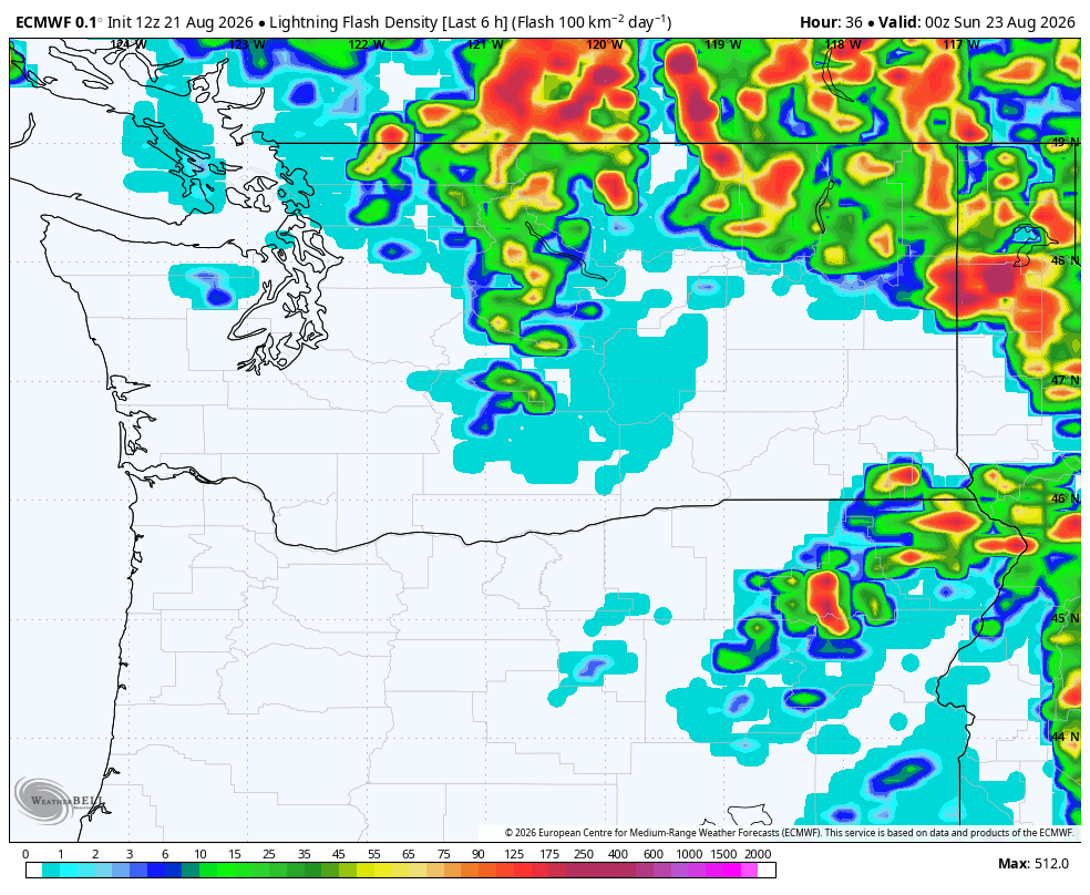
Scattered thunderstorms will start firing over there around midday Saturday, and then the rest of the afternoon and evening will be a parade of roaming thunderstorms moving generally south to north.
Good news: The storms look fairly scattered in nature — no big squall lines or large cluster of storms are expected, so many areas may dodge lightning.
Bad news: These storms don’t look very rainy as with dry air in place, a lot of rain will evaporate before reaching the ground.
That leads to high potential of “dry thunderstorms” where you have lightning to start fires and little to no accompanying rain to douse it. NOAA’s Storm Prediction Center has the northern half of Eastern Washington in a pretty purple “blob” but it’s not great — it’s their “scattered dry lightning” zone – the highest rung they use. It has much of the Columbia Basin under “critical” fire risk due to low humidity and gusty winds.
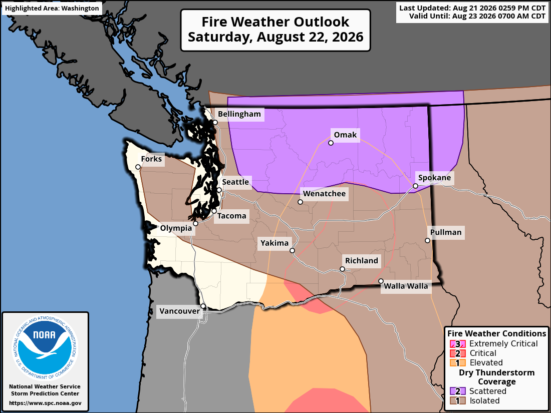
Thus, Fire Weather Warnings cover the entirety of Eastern Washington for that combination of (dry) lightning, gusty and erratic winds near storm cells, and low humidity. It’s another day to be glued to social media and news feeds to be in tune to any sudden fire dangers. The Washington Weather Chasers account will be updating frequently. Check here too…
Thunderstorms linger across the northern mountains Saturday night into Sunday, but taper off elsewhere in Eastern Washington. Though don’t look now but there may be more storms looming in the middle of next week.
IS SUMMER OVER THEN?
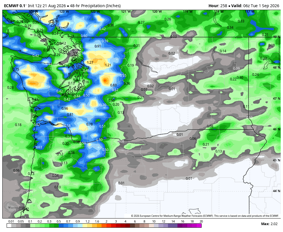
Back in Western Washington, we should briefly rebound early next week to a return of sunshine and upper 70s — maybe notch another 80 on Tuesday. But there is a chance of another round of showers (and isolated thunderstorms?) around midweek. The long range models are still latching on to an idea of perhaps a more significant rain event for… the following weekend.
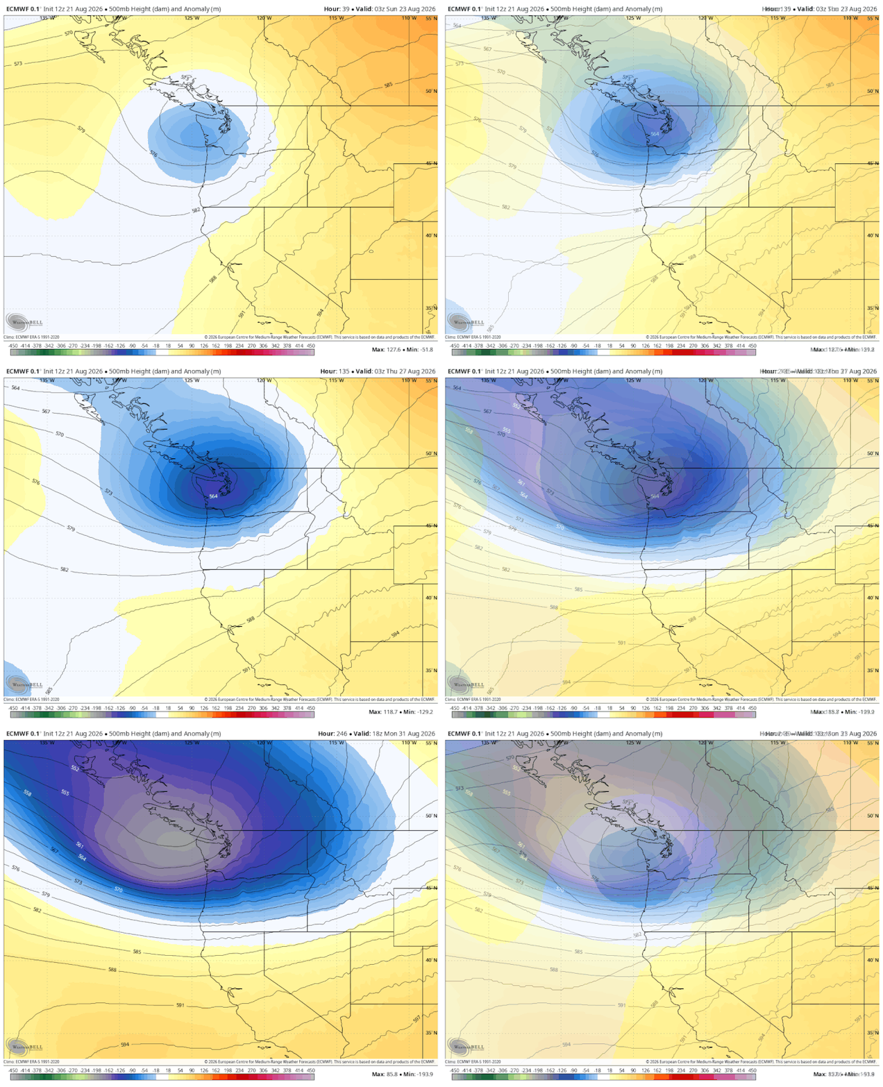
It’s still pretty early for that, but that would jive with the whole Seattle vibe of “sure the two times it rains this summer are on consecutive weekends” (not counting SeaFair weekend too!) NOAA’s 8-14 day forecast outlook into the first few days of September is now trending fairly high confidence of cooler and wetter than average in our region.
Suffice to say, there are no big heat waves looming in the next two weeks. But I don’t want to declare that Friday was the warmest it’ll be for the rest of the year because September can have some late season surprises. But for now, you can probably start thinking about where you want to stash your fans for a bit.
NEAT SEATTLE WEATHER STAT ALERT:
One last tidbit if you’ve ready this far (If so – thanks! TL;DR’s are for the birds! ). Dana Felton with the National Weather Service office in Seattle says this is only the 9th time in the 82 year history of Sea-Tac records that we went through the first three weeks of August with no measurable rain. (Even when we thought on August 1 we’d rain on the “driest day of the year”… it only managed a “Trace.”)
The latest time we went first 3 weeks dry was 2012; it’s only the third time in the past 40 years.
MORE TO EXPLORE:
- What are some scenarios a historic ‘Super El Nino’ could present for the Pacific Northwest and California?
- How ensemble models can help solve the mystery of will it rain this weekend in Seattle?
- Winter is coming: Seattle’s normal high temperatures begin their descent toward January