 Scott Sistek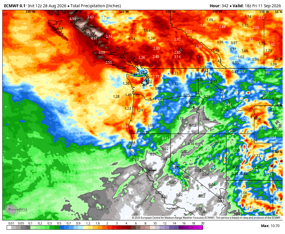
ECMWF predicted total 15 day total rainfall. Look at all that rain in B.C!
The arrival of Pumpkin Spice Lattes isn’t the only thing creating a Seattle buzz this week: The city now has not one, but two decent shots of rainfall over the next several days, and the second one is actually looking like potentially our first significant rainfall in months.
Both systems are taking different tacks, with the first one’s rain more scattered and convergence zone-y, while the second one’s rainfall looks more widespread and longer lasting.
FIRST SHOT: An upper level low will slide down from British Columbia Friday night into the North Sound on Saturday morning, bringing scattered showers — and possibly isolated thunderstorms — along for the ride.
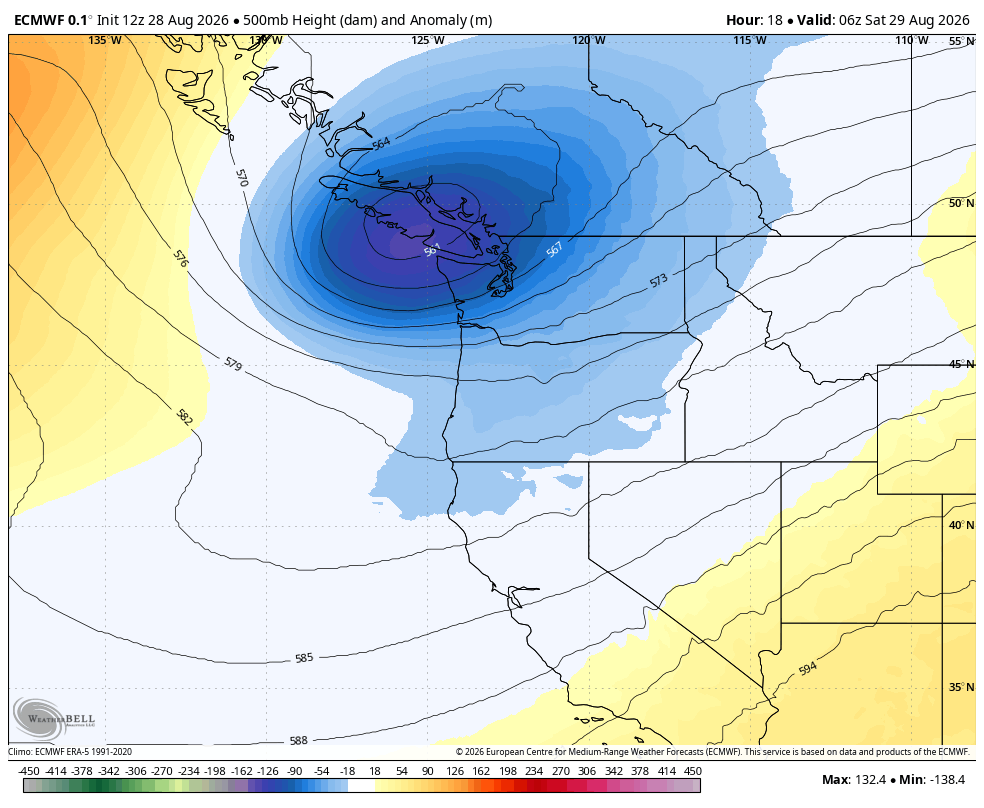
Most of the showers will be north of Seattle in the I-5 corridor, and along the Olympic Peninsula. But even the main Seattle-Tacoma/Puget Sound urban core area is still under the risk of some rain passing showers and a few rumbles of thunder.
The main feature will be a likely robust Puget Sound Convergence Zone that forms early Saturday morning into the midday hours. Right now, it looks like it’ll roam around Snohomish County for the bulk of its journey, though southern Skagit and northern King County may occasionally get the fringe rain.
CAFFEINE BOOST!
The heart of the Zone is where we’ll find the most active weather Saturday, with the best chance for some lightning and heavy rain. Forecast models have been fairly consistent that the Zone could put down a stripe of about a half inch of rain somewhere in Snohomish County. It’ll be a relatively thin band, but where it sets up will get drenched.
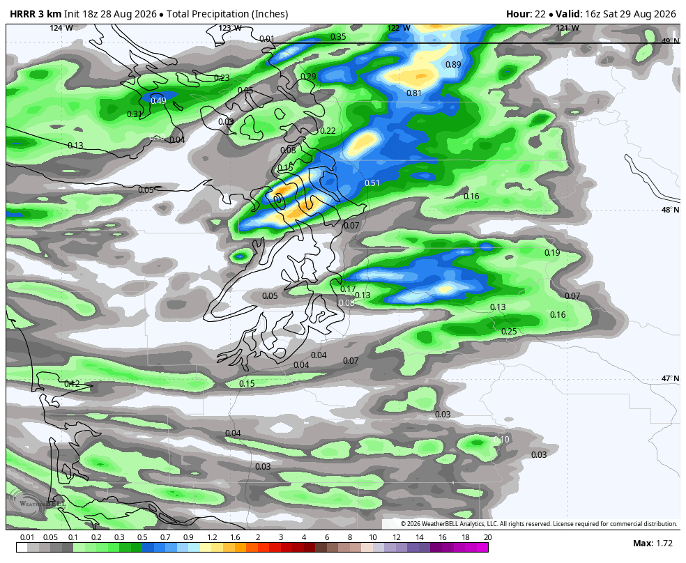
Outside the convergence zone (which autocorrect just tried to change to “conference zone”), rainfall totals will be more scattered and variable, dependent on where the other showers roam. Showers could be briefly heavy but outside the zone, should be in passing.
South of Seattle, the day may remain relatively calm with just a few fringe scattered showers.
Showers in all areas will decrease Saturday afternoon and gradually end as the low moves off to the east. Saturday afternoon and evening may end up fairly pleasant, with sunbreaks even!
We’ll then return to some comfortable dry weather Sunday and Monday, with morning clouds and afternoon at least partial sunshine with highs in the low-mid 70s. Perfect days to soak up those last hours of summer vacation, kids! It might also have been the last hours of sunny skies for the week.
WHAT ABOUT EASTERN WASHINGTON FOR THIS FIRST BATCH OF RAIN?
The northern mountains like the Okanogan range could get a couple tenths of an inch of rain (yay!) late Saturday into Sunday, but lightning may be involved (boo!) and the Columbia Basin looks bone dry (double Boo!). Will have to watch for winds over there too with gusts to 30-35 mph. (Triple boo!)
2ND STORM BREWING FOR GRANDE-SIZED RAIN TOTALS MIDDLE OF NEXT WEEK
Here’s the storm we’ve been looking for, for a while.
A sprawling and potent low pressure center will slide down out of the Gulf of Alaska on Tuesday, increasing clouds around our area as it does so. The storm will then drop south just off our coast into the middle of the week, spinning a front inland with a wave of steady rain on Wednesday.
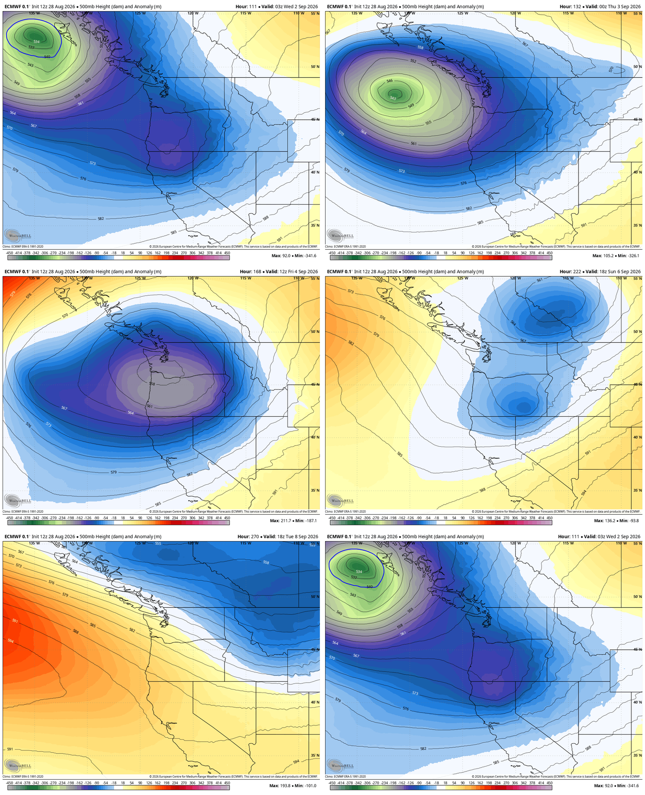
The low is forecast to stall later Wednesday and Thursday, stuck swirling just off Oregon, and still peppering the Pacific Northwest with additional rain showers. Finally, it chaotically reverses course and then slowly cuts back inland to the northeast for another swipe across Oregon and Washington with additional showers Friday into Saturday.
Overall, it means this storm will spend a good four days hanging out in the region, keeping our forecast generally cool and occasionally rainy through the period.
How cool? Highs are expected only in the mid 60s Wednesday and Thursday – our coldest days since mid-July.
How wet? Unlike the hit-and-miss Saturday rain, everyone should get some rain out of this system – and perhaps a decent amount. The European ensemble models are lockstep with the main model of about 0.50-0.75” of rain in Seattle from Wednesday morning to Friday morning, with lighter totals into the weekend. (The Olympic Rain Shadow may limit totals in the North Sound and across the northern islands, but still some rain there.)
On the other hand, the Northern Cascades and Olympics should get at least an inch, maybe 1.5 inches (not as much in the southern Cascades). Sun? No. The cloud map for Washington on Wednesday shows nearly 100% overcast statewide.
CAUTION: OBLIGATORY HIP TIKTOK REFERENCE AHEAD:
If your kiddos have their first day of school on Wednesday like mine does, start having them scour TikTok now for the latest trends in hoodie/jacket ensembles and start earning that Seattle aura by ditching that umbrella…*
(*- Umbrella exception allowed if school photos are taken this day. Or, REALLY earn your Seattle aura by having frazzled “I just came in from the rain and no, I didn’t need an umbrella…”)
WHAT ABOUT WIND?
We’re not quite up to full autumn storm status yet so it’s not looking potently windy, though the North Sound and coast could see some gusts to 35-40 mph late Wednesday into Thursday. Seattle and the Puget Sound area should top out around 30 mph gusts.
WHAT ABOUT EASTERN WASHINGTON?
It FINALLY looks like Eastern Washington will get in on some decent wetting rains!
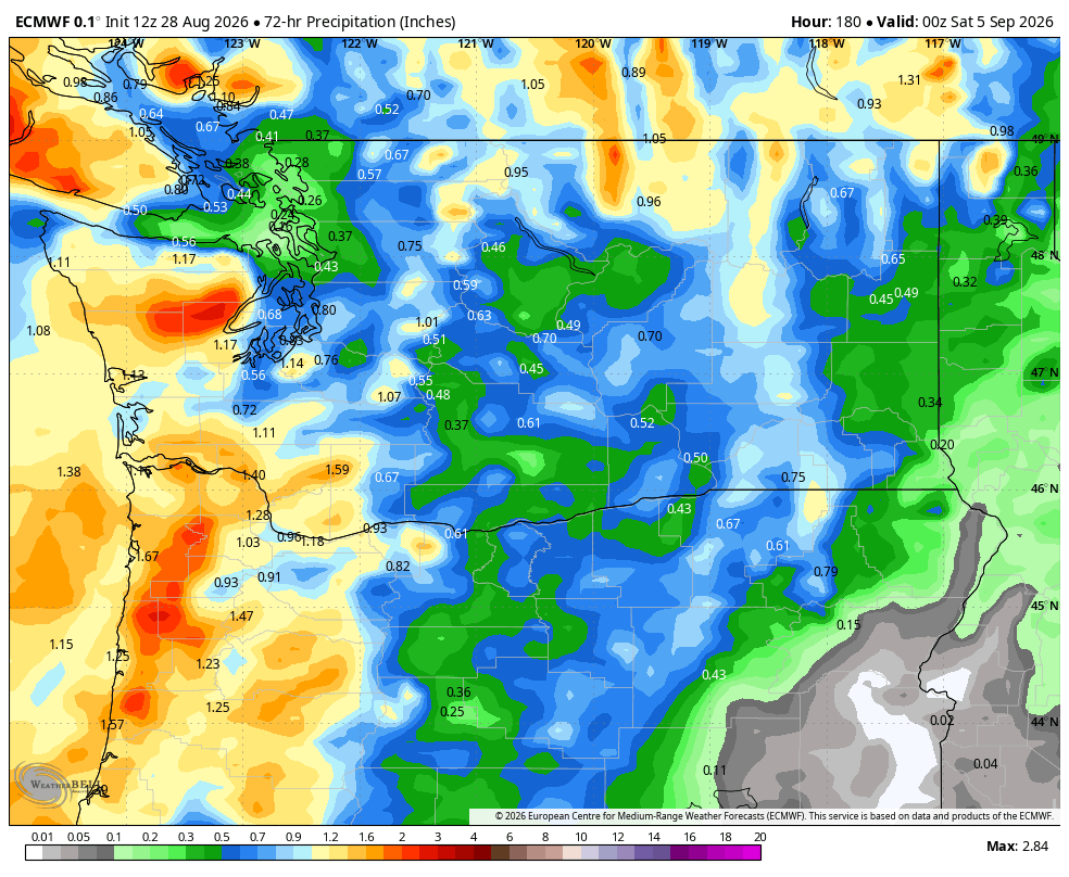
The Euro model shows every part of the state should get at least a couple tenths of an inch of rain with this second storm; many places much more. This probably won’t be enough rain to extinguish the fires but it’ll be a big help and much appreciated.
We should all dry out as we get into Labor Day weekend — maybe a few lingering showers Saturday morning.
But the long range models remain a bit cool and unsettled through the holiday weekend, and then maybe some signs of warming back up a bit as we get farther into the following week. Iced coffees may yet still be a thing!
MORE TO EXPLORE:
- Sunset and severe thunderstorms spawn spectacular sights Saturday over Vancouver Island
- What are some scenarios a historic ‘Super El Nino’ could present for the Pacific Northwest and California?
- How ensemble models can help solve the mystery of will it rain this weekend in Seattle?