 Scott Sistek
Photo by Jingjie wong on Unsplash
It appears it’s not only just the preseason for the NFL and the Seahawks, but it seems autumn is also getting in some early practice this upcoming week.
It’s not a full-fledged early autumn blitz; more like just getting some reps on a few plays, going through the motions, re-familiarizing yourself with the jet stream, and all in all just shaking the rust off (which, I realize for a rainy season, is an ironic choice of idiom.)
You can tell autumn is getting some early work because for the first time in months, we’ve got rain chances from more than one weather system within a week. But don’t worry sun fans, autumn is still only playing the backups right now.
Our first trough of low pressure is on the fairly weak side — think of autumn playing the third-stringers and undrafted free agents — and it will move through on Thursday. It will mostly bring some showers to the mountains (yay!) though a slight chance of thunderstorms there (boo!).
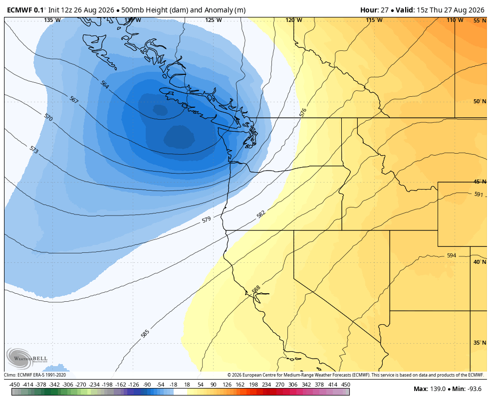
For the lowlands, it’ likely a repeat of the morning marine clouds and then a mix of sun and clouds in the afternoon (and a little breezy — but the “right” breezy to kick out the smoke) with just a few widely scattered light showers that won’t amount to much, if any.
The Euro model is thinking a few tenths of a inch of rain in the Olympics and Cascades with a few hundredths in the lowlands, but the short-term high resolution models are even less impressed with any rain totals. If that’s the case, Sea-Tac may keep their dry-for-August streak another day. Highs will drop to the low 70s.
The trough moves out on Friday, with just some lingering light showers and sprinkles (especially north of Seattle, and ESPECIALLY in the Convergence Zone areas around the King-Snohomish County line) but elsewhere overall just another pleasant mix of morning marine layer, then partial sunshine. Highs stay in the low 70s.
WAIT, THERE’S MORE?!?
Another fairly weak, but a little bit stronger trough moves in late Friday into Saturday — this we may be metaphorically moving on to the second-team backups.
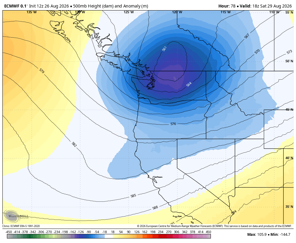
Here we have a decent chance of at least a little measurable rain across the region — still not a lot, but at least enough to maybe have solid evidence that it did, in fact, briefly rain instead of having to scrutinize your car from your home window to see if those are raindrops or did the birds find it instead.
Rain begins in the North Sound early Saturday morning, but for the rest of the region, it’s looking like mostly midday and afternoon showers Saturday with overall light rain totals. But bonus rain forecast again for the Convergence Zone areas along the King-Snohomish County line which looks more robust with this trough — Euro model is going >0.50” there where the zone sticks around. Highs will top out around 70.
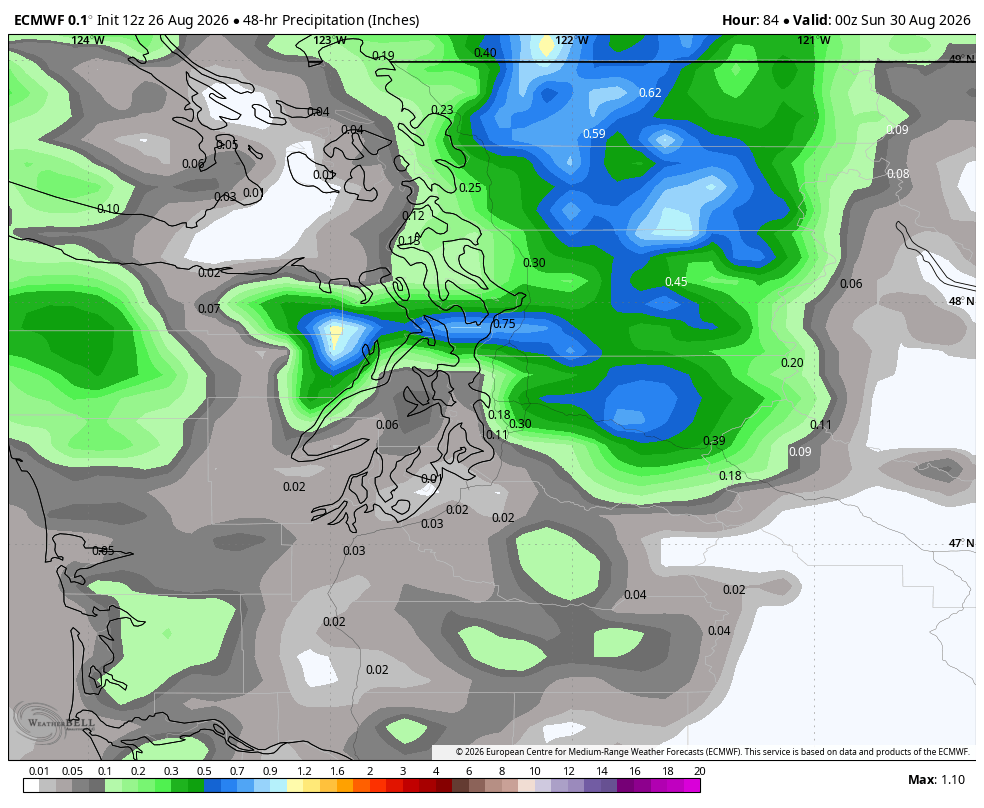
All areas dry out pretty quickly as we get into Saturday night as autumn heads back to training camp to work on a few things and go over the film (and probably finding new meaning to the term “blown coverage”…)
In the meantime, Sunday and Monday are looking pretty pleasant with morning clouds giving way to sun breaks and highs around 70.
IS THAT JSN ON THE WEATHER MAP?
And then, autumn, much like the Seahawks in Preseason Game 3, might say: Hmm, maybe we should toss a few starters out there?
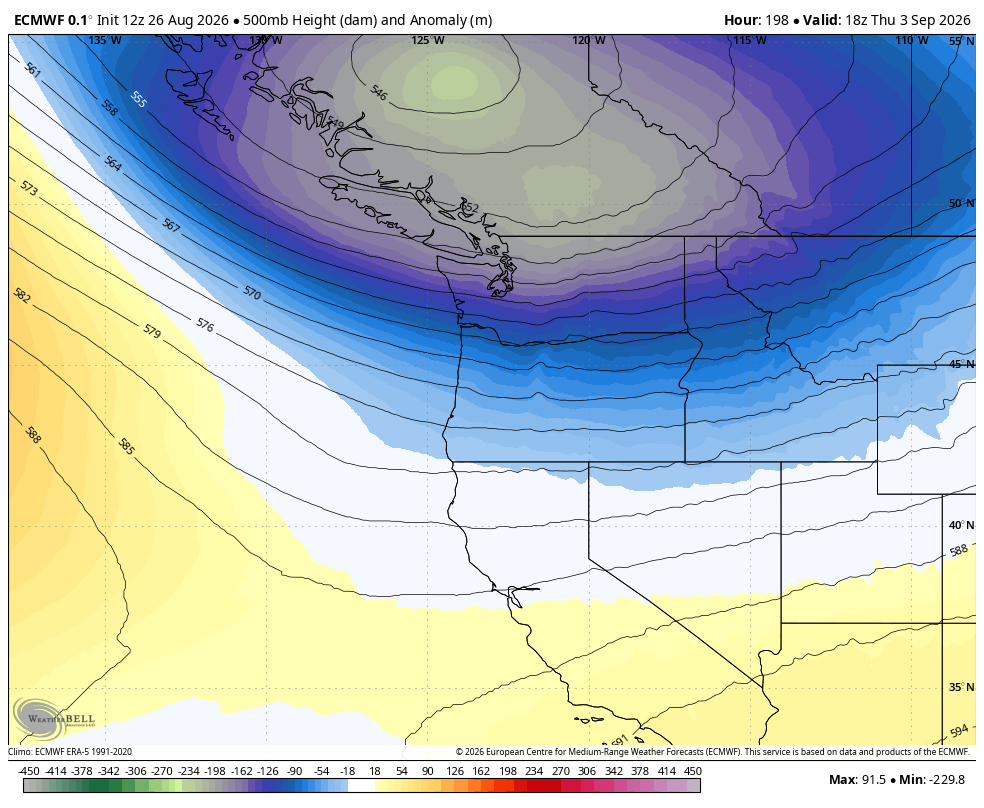
Long range forecast models show a couple of moderate strength troughs sliding through in quick succession in the Tuesday to Thursday time frame next week.
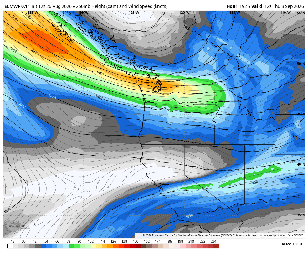
This as of now is looking like potentially the most significant rain we’ll have seen in several weeks (which, isn’t saying much…)
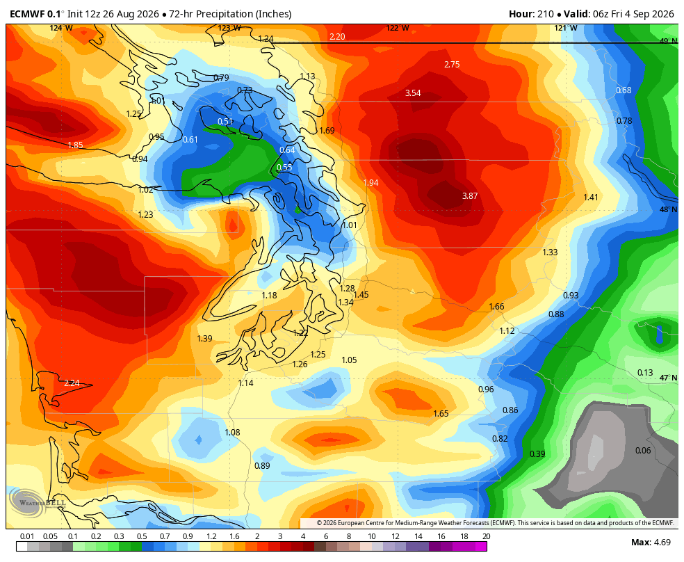
It’s not like problematic amounts of rain and not autumn-like high winds, just finally some periods of steady rains that will feel like autumn is coming. (Sorry kids, I know it’s a lot of first days of school right in the heart of that time frame.)
This will also likely end the streak of 70+ degree days in Seattle. The last day in the 60s was July 16. If it ends Tuesday, it will be the 8th-longest streak at 46 days.
WHAT ABOUT EASTERN WASHINGTON? DO THEY AT LEAST GET IN ON THIS RAIN?
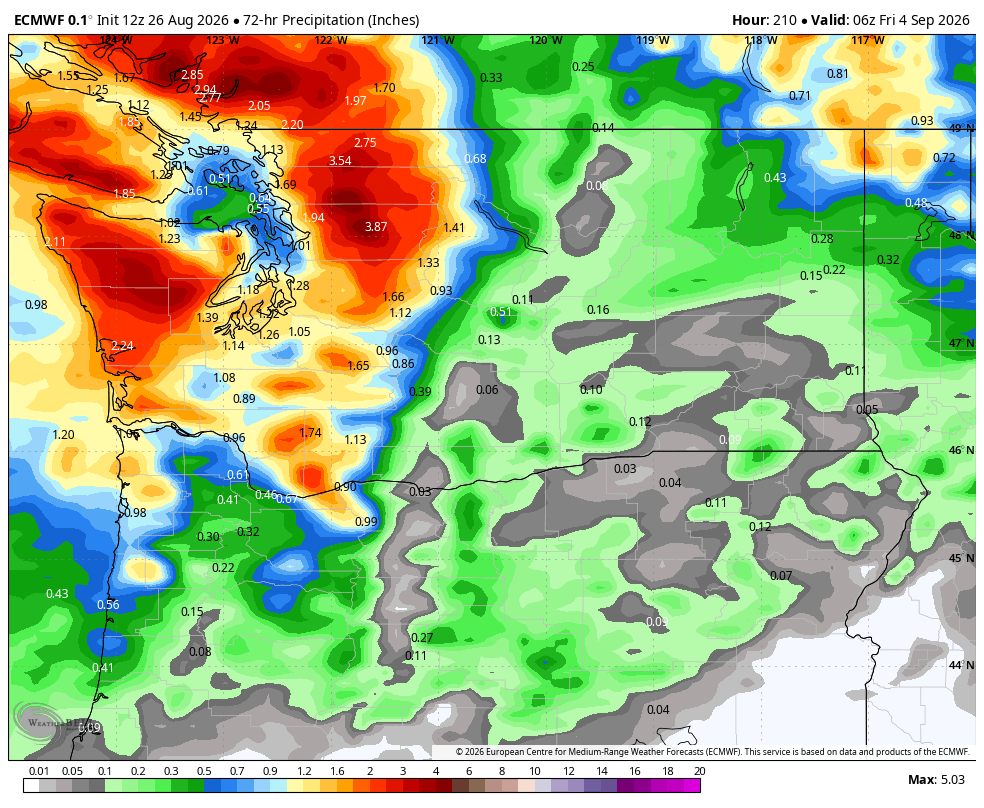
Not at first. Unfortunately, Eastern Washington looks to miss out on both this week’s and this weekend’s rain. The flip in the winds back to the west will help push the smoke back away from the Central Washington foothills and again relegate it to downwind to the east of current fires.
But the flip-flip side is it will be breezy-to-windy at times over there, fanning current fires.
Eastern Washington DOES have some hope of getting at least some rain with the next week’s more robust systems. Doesn’t look like a lot, but some is better than none.
The Cascades — especially the North Cascades — should do a lot better.
SO, IS SUMMER DONE FOR SEATTLE??!?!
Not yet — some of the long-long range models were hinting at some drying and warming after those midweek troughs. But NOAA’s 6-10 and 8-14 day outlook maps are, like the Seahawks, blue (cooler than average) and green (wetter than average) for the Pacific Northwest.
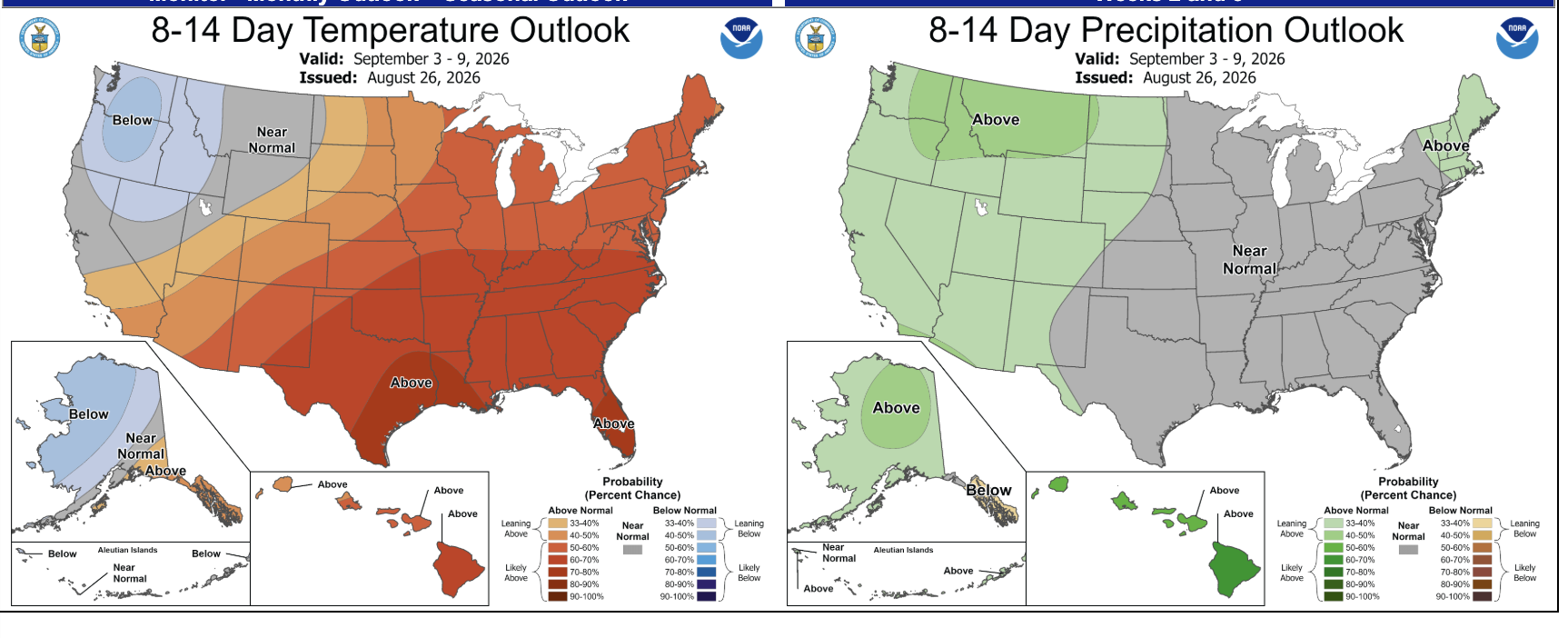
Though with Super El Niño still looming, the overall outlook for autumn remains warmer than average.
But there are no more 80s on the map for Seattle anytime soon.
I’VE READ THIS FAR: GIVE ME A WEATHER STAT COOKIE:
Dana Felton with the National Weather Service is back again with interesting Seattle stats. He says at SEA (-“HAWKS!”), we’re fairly close to average on yearly rainfall (still below though) but it might be noticeable on how little it’s rained compared to average.
Seattle usually averages 97 days with measurable rain through August 31. This year, we’re only at 71. 72 is the current record set in 1985 and last year was second place at 76 days.
MORE TO EXPLORE:
- Sunset and severe thunderstorms spawn spectacular sights Saturday over Vancouver Island
- What are some scenarios a historic ‘Super El Nino’ could present for the Pacific Northwest and California?
- How ensemble models can help solve the mystery of will it rain this weekend in Seattle?
- Winter is coming: Seattle’s normal high temperatures begin their descent toward January