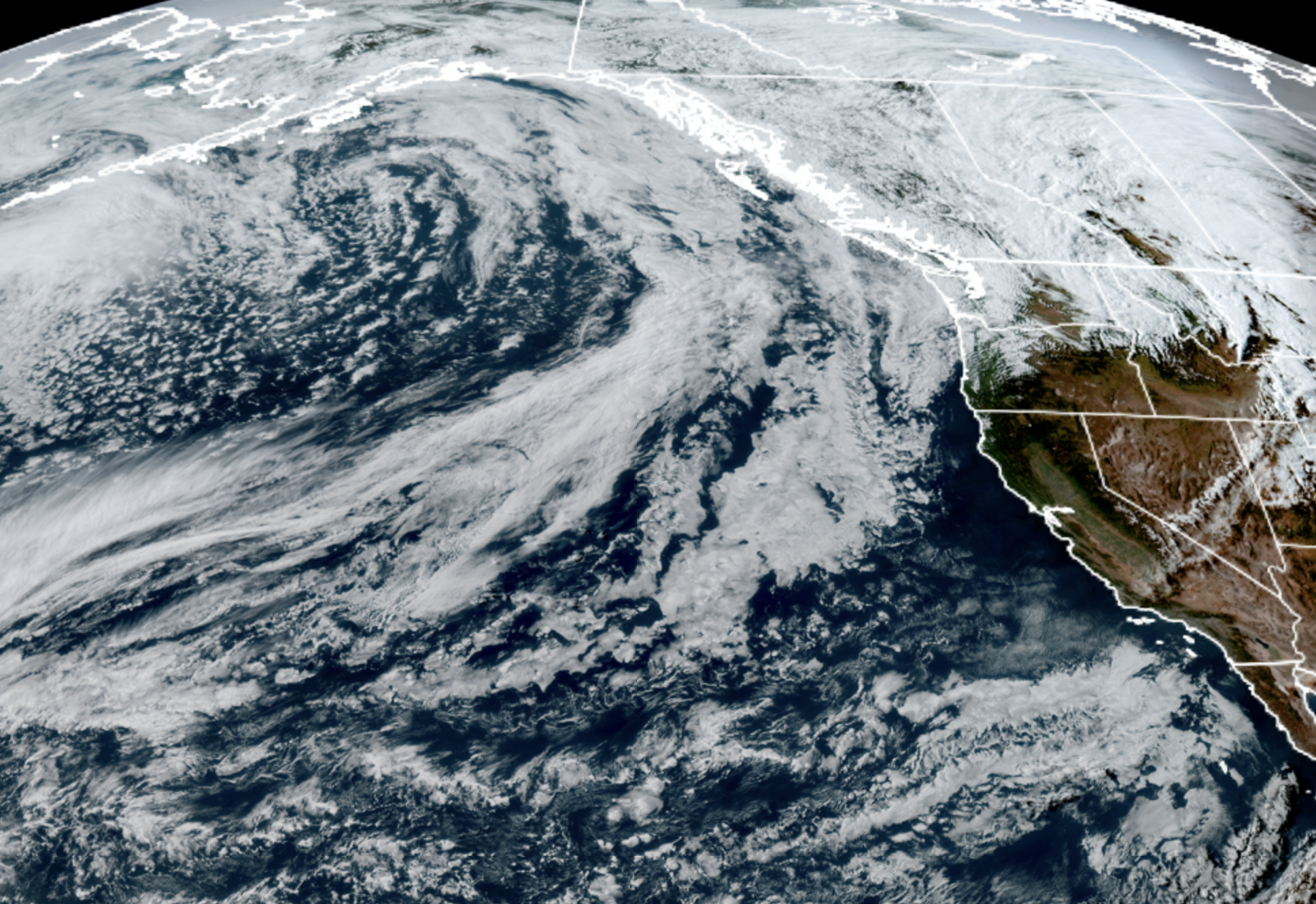
GOES-18 satellite image from May 13, 2026 showing plenty of storm activity out in the Pacific Ocean with our name on it. (NOAA / CIRA / RAAM-B)
I don’t really know what a gamut is, but I do know that whatever it is, it’s been fully run this week in Seattle.
We went from comfortable perfection on Monday with a high of 72, to pushing the heat envelope Tuesday at a record-tying 82 degrees, only to bring in a decent amount of rain on Wednesday along with a few spots of thunder while knocking highs down into the upper 50s — Seattle’s high was 58, a stunning 24-degree drop in just 24 hours.
What’s next? What say we run some more gamuts? Even sprinkle in some mountain snow?
Thursday will feature a break in the rain — still maybe a few isolated showers in the morning — with highs clawing their way into the low-mid 60s.
But on Friday and Saturday, here comes the rain, AGAIN! We’ve got two quick troughs rolling through Western Washington in back-to-back fashion — first on Friday; then a second, stronger one on Saturday.
Both days will feature rain at times and both carry a slight risk of thunderstorms. Friday’s risk is quite slight — though NOAA’s Storm Prediction Center did highlight much of Western Washington in their general risk category — but Saturday’s trough has more in the way of cooler air aloft and in turn, more atmospheric instability.
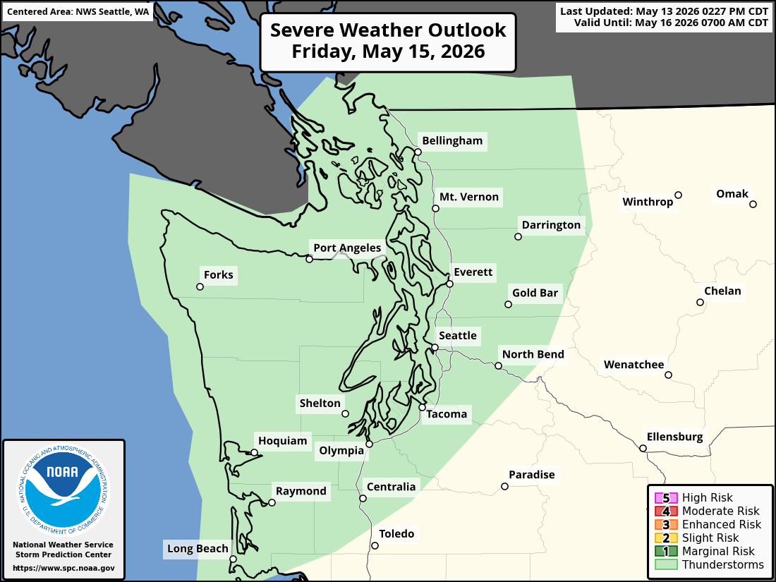
That means a little better chance of thunderstorms for Saturday (especially in the Convergence Zone areas) though at this point the overall risk remains low. (It’s too early yet for the SPC to weigh in; it only does thunderstorm outlooks out three days.)

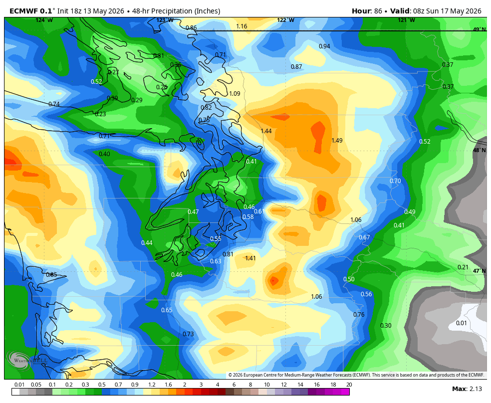
But after 13 days in a row with no rain (before Tuesday night’s showers), we can certainly use a wet couple of days. Rainfall totals combined between the two systems look to be around 0.30-0.50” for the Puget Sound lowlands. Highs will drop back into the 50s.
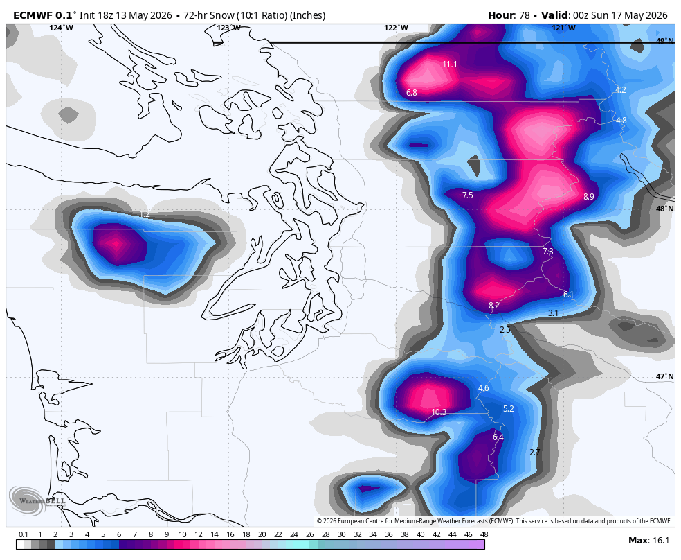
Meanwhile, snow levels will drop to about 3,500-4,000 feet by Saturday into early Sunday. Any snow the passes looks wet and road temps are warm so not thinking too much travel issues but anyone thinking of going hiking or camping this weekend in the Cascades needs to watch out for rain on Friday then rain or wet snow (or just plain snow if you’re going up high) and possible thunderstorms on Saturday.
Models show a couple inches of wet snow in the mid altitudes and about 6-8” along the higher peaks.
We should quickly dry out Saturday night and get back to leaving gamuts alone and instead, running on sidewalks or tracks or hiking trails next week. Monday might remain a bit cloudy but overall next week is looking sunny-ish with high temps on a slow climb through the 60s.
(Now, to find out what a gamut is….)