Seattle heat and smoke forecast: Next weekend trending in the wrong direction
 Scott Sistek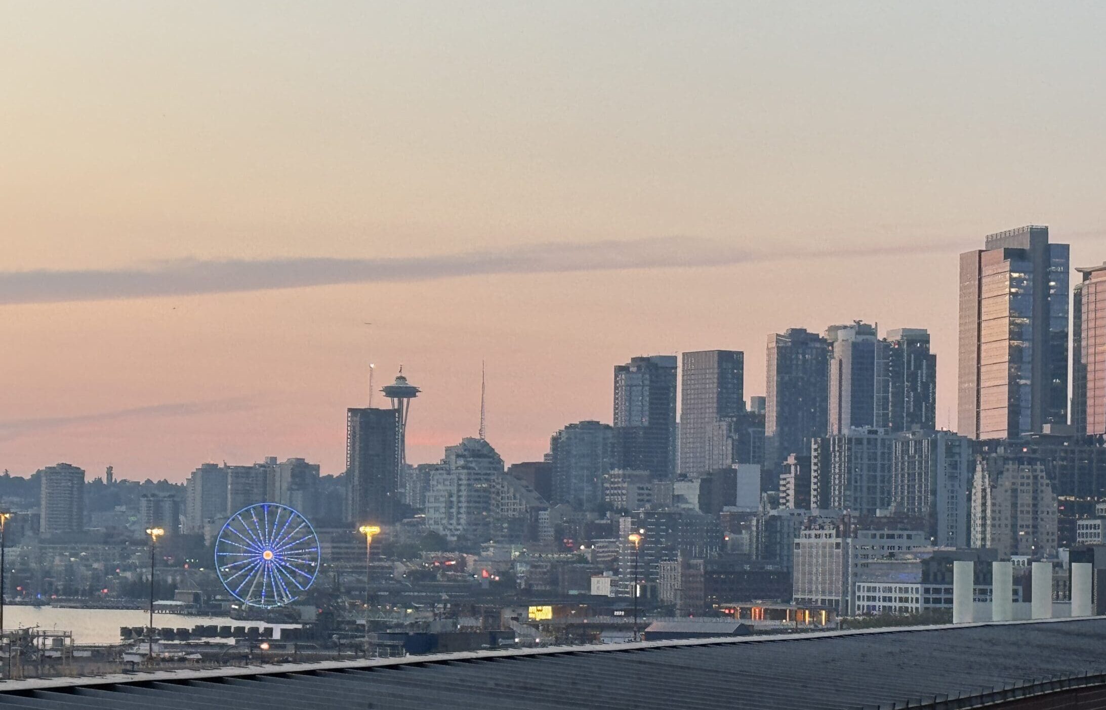
Seattle's skyline as seen from T-Mobile Park on Aug. 7, 2026.
(TL;DR: “Too Long; Didn’t Read” synopsis: The weather pattern for Washington is pretty stable for the next several days with steady ocean winds keep air clear on the west side and at least “kinda” a little better for areas on the east side not directly downwind from a fire. But the long range forecast is trending back toward hotter… and at least some potential for maybe smokier.)
After a few false starts last week, the cooling marine push has finally cleared out the smoke from Western Washington and at least brought “some” air quality improvement to parts of Central Washington.
We on the westside are literally “in the clear” for a little while now, but I don’t like the looks of where the forecast is heading.
Let’s break it down.
WESTERN WASHINGTON: SUMMER NORMALCY RETURNS THROUGH MID WEEK
If the rest of the weather situation weren’t so troublesome, we’d be excitedly talking about the perfect summer pattern in the offing.
Now that the westerly marine breezes have returned, they are here to stay through about Wednesday with clean, cool ocean air pushing inland each night bringing some areas of morning clouds that will clear to sunshine with no air quality concerns in the west.
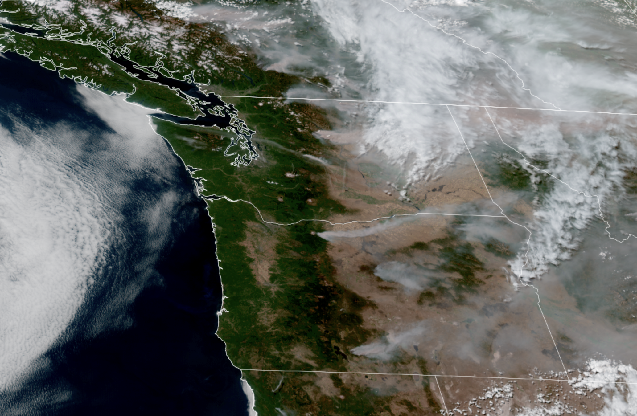
Highs will be right around the upper 70s to low 80s. Thus, all weekend outdoor plans are a go, just be mindful if heading to the Cascades of the fires going on.
EASTERN WASHINGTON: STILL FIRE WEATHER DANGER THROUGH SATURDAY NIGHT, THEN BETTER
Red Flag Warnings (aka “Fire Weather Warnings”) remain in effect for much of Central and Eastern Washington through the rest of Saturday — or in the Chelan/Wenatchee area, until 6 a.m. Sunday — for the dangerous combination of gusty winds to 25-30 mph and low relative humidity of under 20%.
However, winds will ease tonight, and Eastern Washington too will return to “summer normalcy” of average August heat and dry conditions, but relatively calm winds and (relatively) higher humidity. Of course, the hot weather and ultra-parched land means it’s still very easy for new fires to spark but any spread should be slower.
The steady west winds will keep smoke on the move in Eastern Washington from west to east and air quality will still be poor downwind of current fires. The Wenatchee/Yakima area should be in better shape though, with better ventilation from the west and less active fire upwind.
WEDNESDAY INTO THURSDAY: LIGHTNING MAY REENTER THE PICTURE
Much like the skies in the east, the forecast is getting hazy toward the middle of the week. Some of the latest models indicate a weak system will slide across B.C. and Alberta and the southern tail may drag across the northern edge of central and eastern Washington.
It looks too weak to bring any rain, but may bring just enough instability to trigger some thunderstorms right along the far Northern Cascades and the Okanogan Range on our side of the Canadian border (some lightning possible in B.C. side too.)
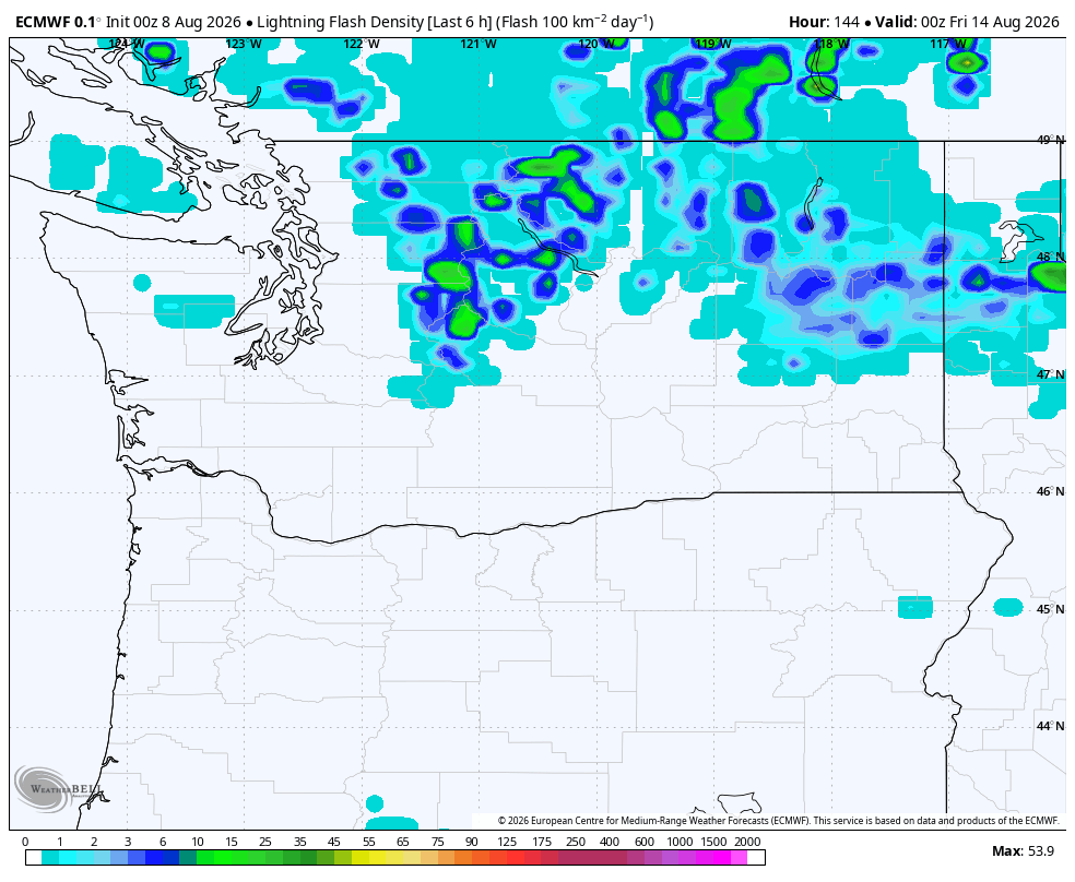
Right now the storms look minor, if any. But ANY lightning right now is unwelcome. We’ll of course keep an eye on it.
(No impacts forecast for Western Washington for this blip, aside from perhaps slightly increasing the marine push Wednesday and cooling us a couple degrees.)
END OF NEXT WEEK: THE HEAT (AND SMOKE?) RETURNS?
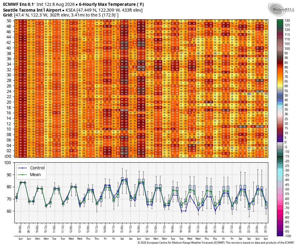
While still not very high confidence yet being nearly a week out, the long range forecasts are trending hotter on both sides of the Cascades for Friday and next Saturday.
Looking at the Euro ensemble model from Saturday, which runs 50 versions of the forecast with minor tweaks to get a broader sense of possibilities, about 30 of the 50 model versions have high of 85+ in Seattle, with 8 out of those forecasting 90+. (The other 20 went 84 or cooler). That’s still quite a spread, so thus not high confidence, but the model average is about 86-87 right now.
The corresponding wind patterns look like we could see a return of easterly wind drifts in Eastern Washington (though not as strong yet), which could push the smoke back up into the eastern Cascade foothills. In the West, it would at least be a shift away from westerly to northerly to possibly northeasterly winds, which could re-import some smoke from B.C. (though that would hopefully just be aloft).
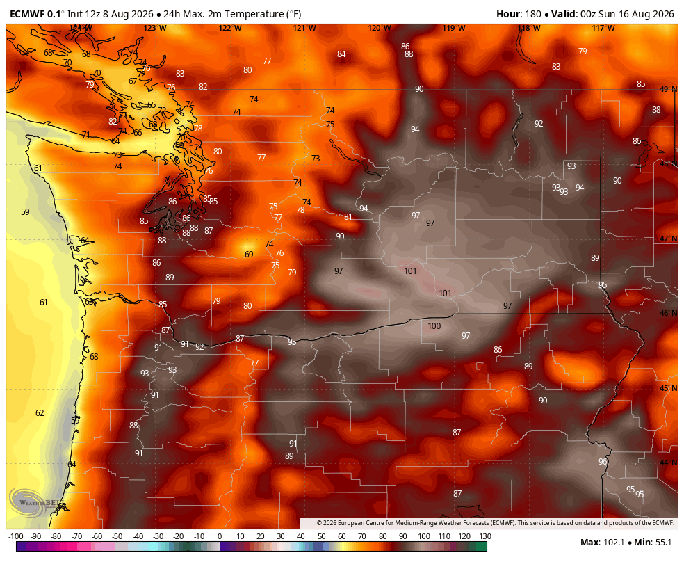
If the hotter solutions come to pass, that would indicate potential of more of a return to due east winds like we just went through last week and we could be back to hot and smoky in Seattle and the west side.
Silver lining: The hot pattern, IF it comes to pass, looks like it wouldn’t last as long as this last one. But it’s something we’ll have to watch as this week progresses. And of course, if it does get hot, when it cools off, we’ll deal with the west wind surge and critical fire weather conditions in Eastern Washington again.
IS THIS JUST GOING TO KEEP HAPPENING?
Unfortunately, I think this cycle is going to be the reality of the rest of our summer in the Pacific Northwest. We’re still two months away from even the early edges of the rainy season.
And with strong El Niño already in place and getting stronger, and El Nino’s propensity to keep things drier in the Pacific Northwest, fire and smoke may be a factor for quite some time. And any time the weather pattern shifts away from a west wind, we’ll be at risk of importing smoke.
But if anyone has any magic spells lying around for how to make a rainy September and early autumn start in the Pacific Northwest, this might be the time…
MORE TO EXPLORE:
- Here is how to find and read wildfire smoke forecast models for Seattle and the U.S.
- Seattle nearly had its hottest rainy day on record
- Cool ‘fire rainbow’ clouds grace sunny summer skies over Western Washington