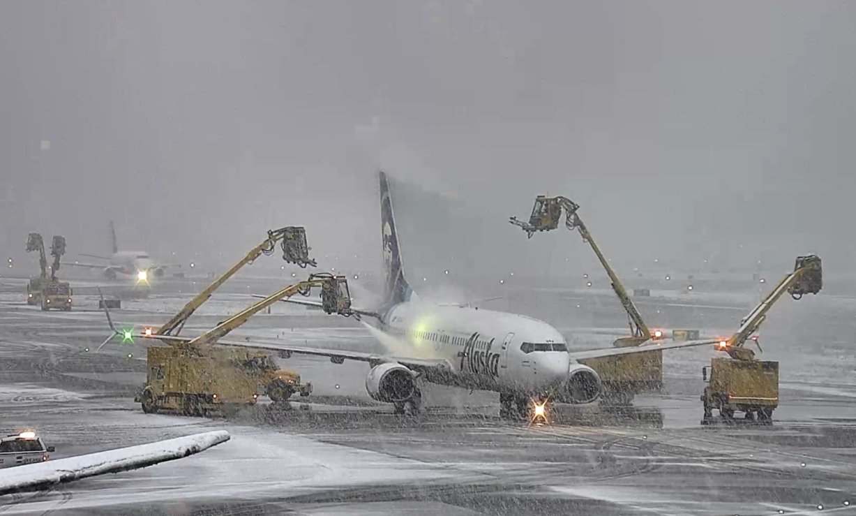
Snow falls at Sea-Tac Airport on March 13, 2026. (Photo courtesy: Sea-Tac Airport)
I have to say I’m impressed. Usually these are the types of fringey snow patterns that totally bust. But no, most people at least got to see some snow, even if it didn’t stick much, which was pretty much on par with the general forecast.
But for those of you between about Seattle and Olympia with a little elevation? Boy did you win the snow lottery!
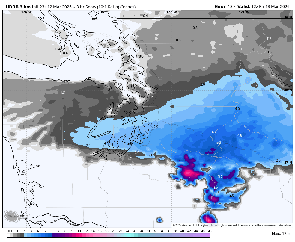
The weak atmospheric river that’s been hanging around northern Oregon much of the week drifted north overnight into Western Washington to bring us moisture, while cold air on the backside of Wednesday’s windstorm pushed down against it, gradually cooling us off close-ish to freezing.
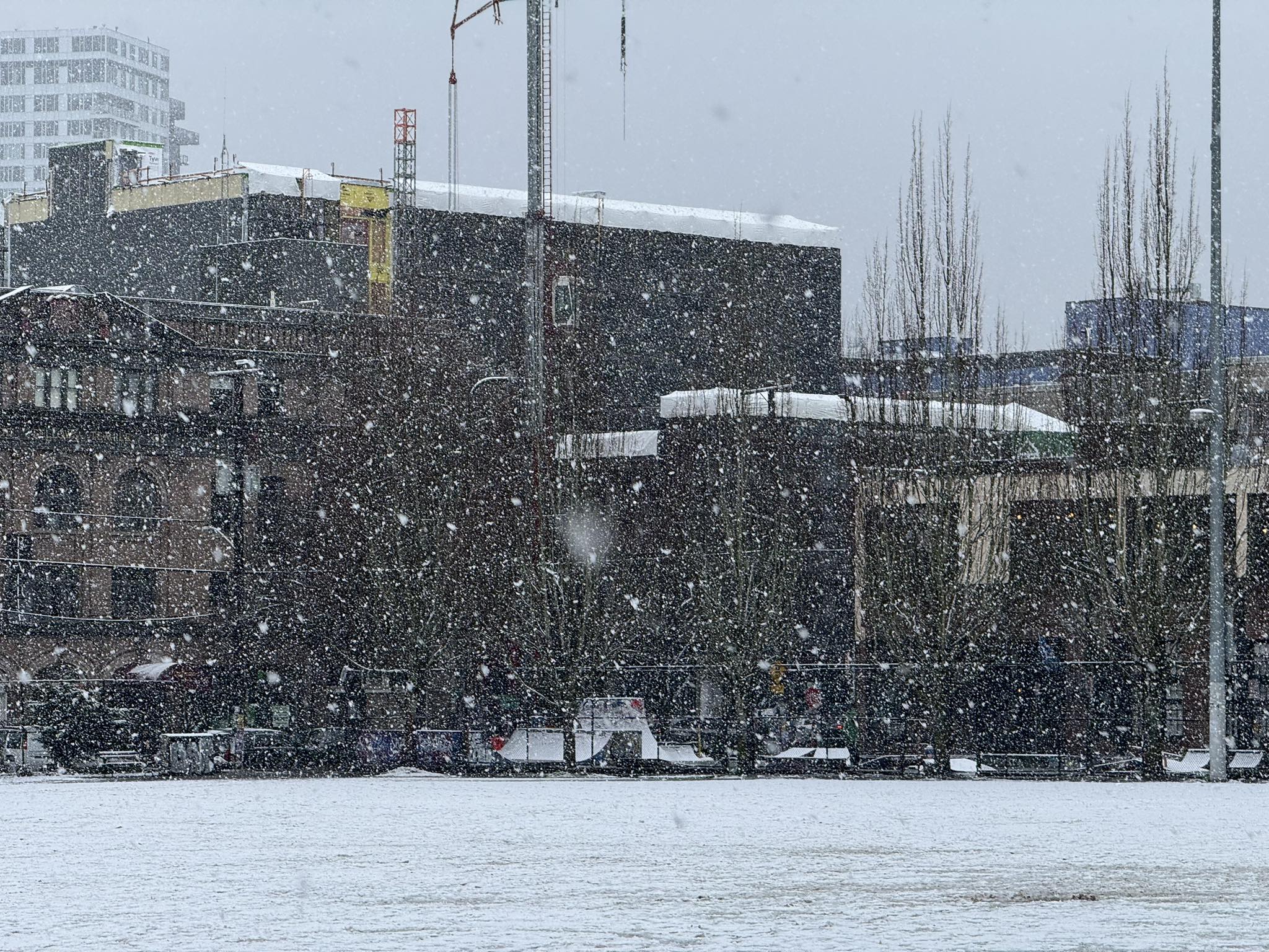
From Seattle north, the “close-ish” to freezing meant we were about 2 degrees too warm to really get it to stick, and instead were treated to 15 hours of snow that didn’t amount to much of anything.
But there was that one narrow band between Seattle and about Lakewood or so that was in the PERFECT sweet spot where they were on the cold, north side of the frontal boundary — close enough to the cold air side to chill; close enough to the heart of the front to get the moisture. And the increased precipitation cooled the air even a more and brought snow levels down to a couple hundred feet.
The good news was that the days of warm leading up to it meant the roads were warm so we didn’t get too much snow sticking to the roads.
But Sea-Tac Airport, being around 400 feet, was inside that sweet spot where it has snowed for several hours right at 32 degrees.
To give an idea of how tight the temperature gradient was inside the front, while it was 32 and snowing at Sea-Tac, it was:
35 in Tacoma
37 in Chehalis
45 in Kelso
55 in Vancouver
HOW UNUSUAL WAS THIS SNOW FOR MARCH?
The preliminary Friday evening snow total at Sea-Tac is 3.0 inches so far and it was still snowing! But even if it stopped at 3 inches, it’s unusual in many ways:
- The 3.0” makes it the snowiest March 13th on record in Seattle, besting 1.7 inches set in 1955. (That’s not saying much because March snow is so rare.)
- What was tied for the 4th-least snowiest winter on record (at a “Trace”) has now dropped to the… 28th least snowy winter.
- We now have more snow than last winter (2.3”) which had snow on 8 of the first 9 days in Feb but didn’t really hit the airport.
- At the moment, 3.0” ties 2009 for the 9th snowiest March on record (8th place is 3.3” so that is still in reach.)
- This is only the 3rd winter where March was our first measurable snow of the season
- This is only the 6th winter where March is our heaviest snow.
- The past 48 hours have seen Seattle set both its windiest and snowiest day of the fall/winter season… in mid-March!
IS THERE ANY MORE SNOW?
There was still a chance of a few more snow showers overnight Friday — mostly in a the King or Snohomish County foothills and other spots where a Convergence Zone may form, but much less moisture than last night and again temps are fringey to where accumulations are slushy and spotty.
The snow around Sea-Tac was expected to dissipate by about 9-10 p.m.
Going forward? I am about 99.9% confident this is our last chance of lowland snow for the winter.
WAIT THAT MEANS 0.1% CHANCE IT’LL HAPPEN AGAIN! YOU CAN’T STOP ME, I’M GETTING MY HOPES UP AGAIN WOOOO!
If anything, we’re going the opposite direction. Signs are still building that a much warmer atmospheric river that could rate a 3 or 4 on the 5-point scale looming for either the Pacific Northwest or southern B.C. for much of next week.
The models have been varying where the heaviest rain-train sets up — the past few days it’s been leaning more into B.C. but more recent ones are bringing the focus back toward Washington and Oregon. If that verifies we’ll need to watch for potential flooding next week :/