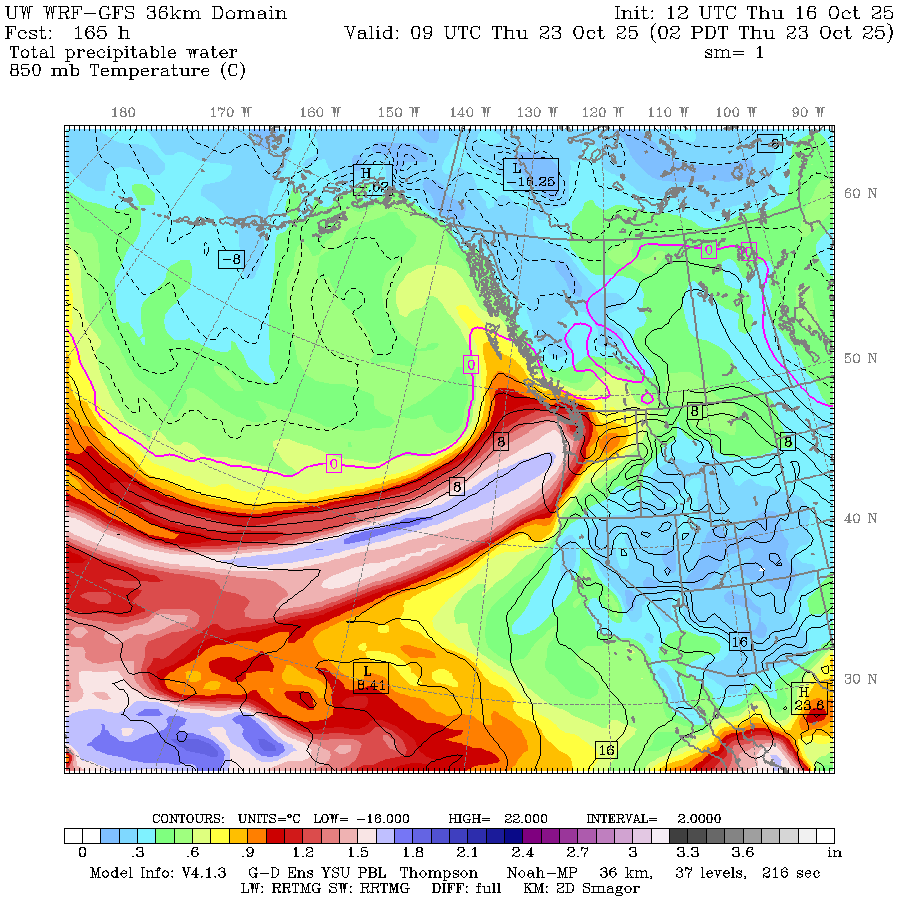
UW-WRF GFS map showing predicted atmospheric river plume on Oct. 23, 2025.
There are a few things you can always count on in Seattle: You are never more than 350 steps from an espresso stand, umbrellas collect more dust than raindrops, and traffic in the far left lane goes slower than those in the right lanes…
And the stormy weather finds its way into Seattle in late October — in this case, perhaps sometime late next week.
NOAA is picking up on stormy signals in the long range forecast and is starting to raise awareness about a bout of rainy and windy weather in the offing. So far, there is nothing alarming in the forecast — it’s more “noteworthy” than alarming at this stage. But we have an opportunity to give you an early heads up, so… “heads up” 🙂
WASN’T THERE SUPPOSED TO BE A STORM THIS WEEKEND?
Actually yes, and there still is. A brief weak-to-moderate atmospheric river will bring a period of steady moderate to heavy rains late Saturday into Sunday. It doesn’t look as wet as it did a few days ago so while yes, wet, it is not looking like impactful amounts of rain. A couple inches are expected in the Olympics and Cascades; about a half inch or so in the lowlands.
We should get what qualifies as a relative break Monday through Wednesday — still a risk of showers each day, especially Tuesday but nothing bothersome.
SO WHAT’S WITH THE NEXT WEATHER MAKER?
It’s later in the week that the long range forecasts are signaling potential for a stronger atmospheric river and maybe even some wind, especially coast and Northwest Interior — the usual windy spots. (Yes, this blog is once again sponsored by the em dash. Get yours today — technical writers are standing by! Call now and get a free Oxford comma! It’s free, light, and useful!)
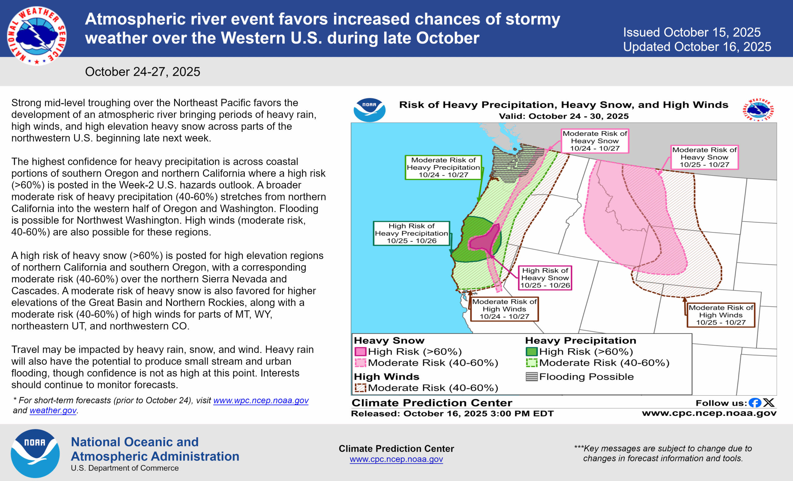
NOAA’s Weather Prediction Center has highlighted a myriad of potential weather impacts from heavy rain to strong winds to heavy mountain snows across the Northwest. (Although while there are no alerts posted yet, I think we have to issue a NEAPOLITAN ICE CREAM Watch for that map with those colors? And I guess we tossed in some mint chocolate chip for good measure? Hey, did we just create a new flavor?!?)
It’s still too early to get specifics yet on how much rain or wind or mountain snows — even Thursday’s update was a tweak from Wednesday’s initial map in that the focus of the heaviest rain potential drifted south to southern Oregon/Northern California and it pushed back later in the week for timing.
This far out, the long range models spin different tunes each update. Some of spun up a “bowling ball” low pressure center and rolled it around Vancouver Island which would portend stronger wind potential, but again nothing alarming yet, just noteworthy.
We’ll keep you posted!