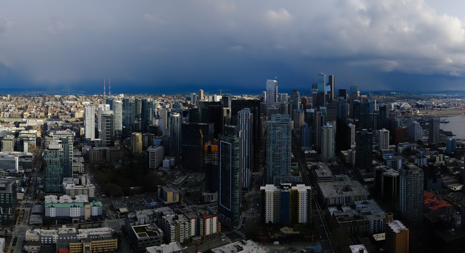
A snow shower falls in the distance to the south of Seattle as seen from the Space Needle on Feb. 17, 2026. (Photo: Space Needle Web Camera)
Were the brief snow showers Tuesday and Thursday in Seattle what this entire winter is going to muster for snowfall?
I guess the TL;DR for today is pretty simple: “Yup….”
Lame.
Or at least it’s looking like it’ll take a meteorological miracle for any more snow chances in Seattle this winter. The New England Patriots put up more of a fight than La Niña did this winter for us.
About the last gasp of winter is Thursday night, where clearing skies and leftover chilly air from the Fraser winds will allow temperatures to drop into the mid 20s or so. It has a chance to be the coldest night of the winter in Seattle — we had 2 nights at 26 in January; low so far is about 27.
But this winter looks like it’ll be known for only garnering a Trace of official snow — 34 minutes on Tuesday; 39 minutes during a quick shower midday today, and never snowing when it was any colder than 37 degrees.
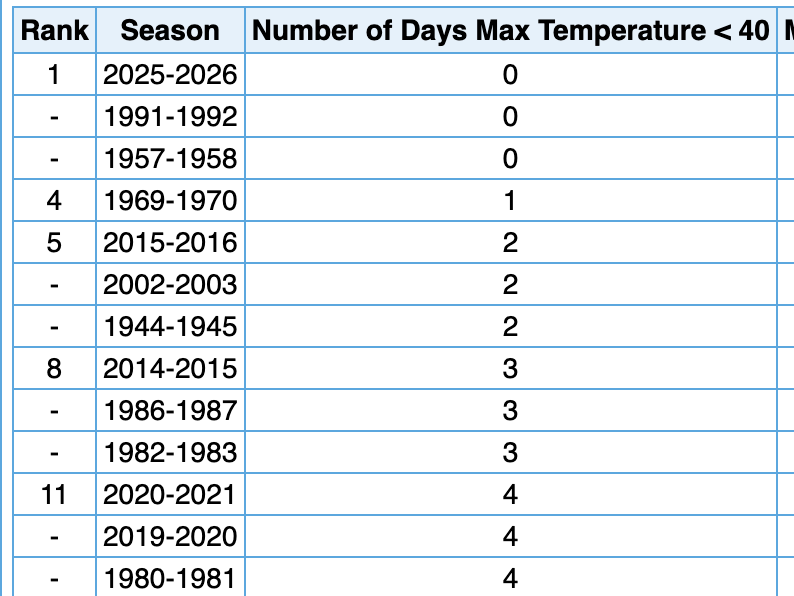
Oh, and FOR ONLY THE THIRD TIME IN SEA-TAC HISTORY — we’re likely going to go the entire winter not managing one day without reaching at least 40 degrees, matching 1957-58 and 1991-92. Even the ungodly “winter” of 2014-2015 managed two days stuck in the 30s.*
(*-OK This is totally ripe now for me to jinx this and we’ll get some freak arctic outbreak in March. But if I *want* it to be a jinx, does it reverse a jinx?)
So where do we (actually) go from here?
We’re dry on Friday with some sunshine but still a little lingering chill with highs in the low 40s.
This weekend, another big trough of low pressure will take up shop well off our coast, but this one will spin a pair of “mini lows” around a bit like a merry-go-round from south to north off, but closer to the coast.
Each passing low will give us a glancing blow of lowland rain and mountain snow on both Saturday and Sunday-into-Monday.
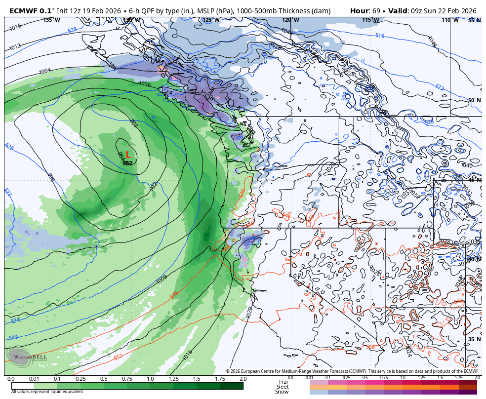
The rain and mountain snow amounts will be uneventful — I think pass travel should still be manageable. But Saturday’s low may be just strong enough to draw in a period of gusty east winds along the coast and Cascade foothills through the mountain pass gaps (like North Bend, Enumclaw, Gold Bar, Snoqualmie, etc.).
This is not looking like a major wind event by any stretch, but Euro model suggests maybe some east wind gusts of 40-45 mph Saturday evening into Saturday night. For those not in places susceptible to east winds — essentially anywhere not along I-90 or the immediate Cascade foothills — the winds won’t be a factor. Temperatures will warm back closer to 50. It may be a while till we even see highs in the 40s…
Next week’s weather remains fairly mundane so far with perhaps a dry day either Tuesday or Wednesday and then another system looks to drop in from the northwest sometime in the middle to late next week that might do a better job of putting a decent snow in the mountains. Down here? Just more rain.
Where does the cold air go from here? The correct answer may be: “What cold air?” Looking at the 6-10 and 8-14 day outlooks, it appears winter is getting cancelled in 49 out of 50 states. (Hi, frigid Alaska!)
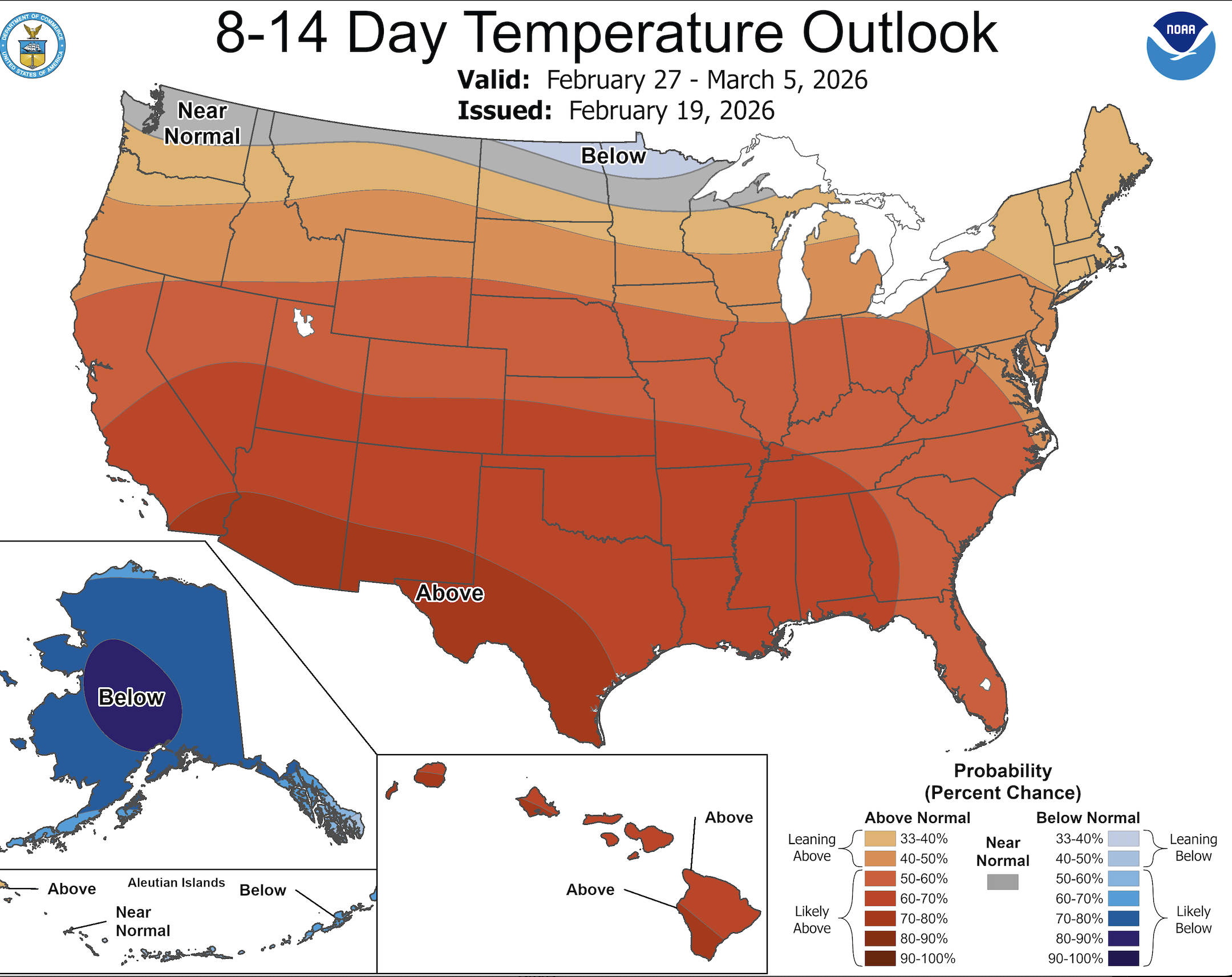
Though there is some solace that at least the Seattle area is closer to normal, and that should keep snow going in the mountains. But the snow is totally done in the lowlands. Book it. Print it. Broadcast it. Scott says so. Totally won’t jinx it AT ALL….
Another thing about this “winter”. The barometer stayed at or above 30.00 inches for almost 5 weeks straight in January and early February. I can’t remember that happening before.
Everything about this winter has been unusual.
ElNino is rearing its ugly head for next year and it looks pretty strong. Since LaNina didn’t come through can ElNino appear and bring us snow next winter?
The answer is yes it can. We had a moderate ElNino that winter and Seattle got 67 inches of snow. January alone had 45 inches. We missed 10 days of school that January.
So..maybe next year.
I forgot to add the year to my comment. It was 1968-1969.
La Nina has left the chat.
I would say that Saturday’s low was indeed strong enough to get the wind gusting along the Grays Harbor coast. It was quite gusty from late Friday night until early this morning. Its now pouring rain with thunder. Definitley feeling like a more typical Northwest winter again.