Seattle to get hit by a series of atmospheric… ‘brooks’ instead of ‘rivers’?
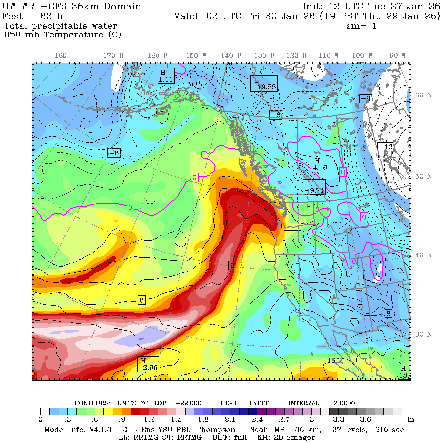
Atmospheric Moisture Plume map for Jan. 29 (Why does this map always look like we're being attacked by the Loch Ness Monster?)
Seattle’s January dry streak is finally ending as series of weather systems head our way.
MEGARIDGE is R.I.P. and the first of what will likely become a modest few days’ rainy streak begins Wednesday.
As you might have heard, the “atmospheric river” moniker has been getting tossed around in the Seattle forecast lexicon again — and it’s true. The storms forecast to come in this week do meet the technical criteria to earn the “atmospheric river” name, especially the ones Thursday and Friday and then a weaker one on Sunday into Monday.
But as a testament to “not all AR’s are destructive”, these will certainly fall into that non-destructive category. In fact, my headline up there is tongue-in-cheek that maybe these upcoming systems are more like “atmospheric brooks” than rivers. (Or maybe more like a “Pineapple Parkway”)
We do have plumes of moisture that have tapped into some mild, tropical air from farther south in the Pacific Ocean, and thus it’s going to be warm rains again (Boo!) on Thursday and Friday.
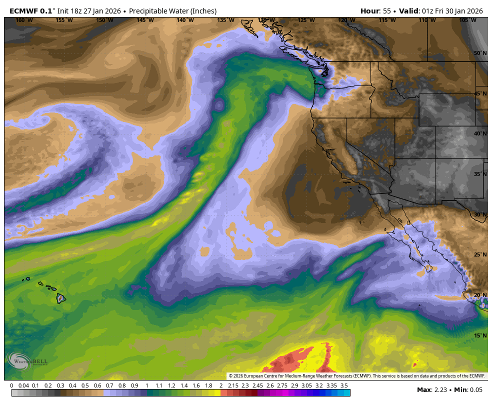
But while it’s a decent amount of moisture, it’s not gobs of moisture — at least compared to some of our really wet ARs from November and December. The folks at UC San Diego who keep track of such things are rating these versions mostly a 2 out of 5. The ones in autumn were solid 3s and even some 4s (the flooding one in December was a borderline 5.)
Saturday looks like a potential pause in the rain with the next system winding up off the coast a while and drawing in some warmer air. Some spots might get close to or even hit 60 degrees on Saturday.
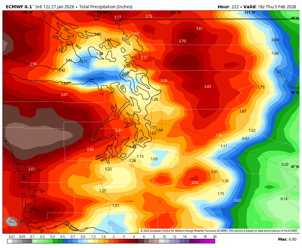
Then the next weaker system returns the rain Sunday into Monday. The Euro model pegs about 1.5 inches of rain in the Puget Sound lowlands combined through all the systems into about Monday, and about 3-5 inches of (mostly rain) in the mountains (maybe a little more on the windward side of the Olympics.)
So overall, it will still be rainy at times and it will still be mild (BOOO!) but we should make it through without a scratch.
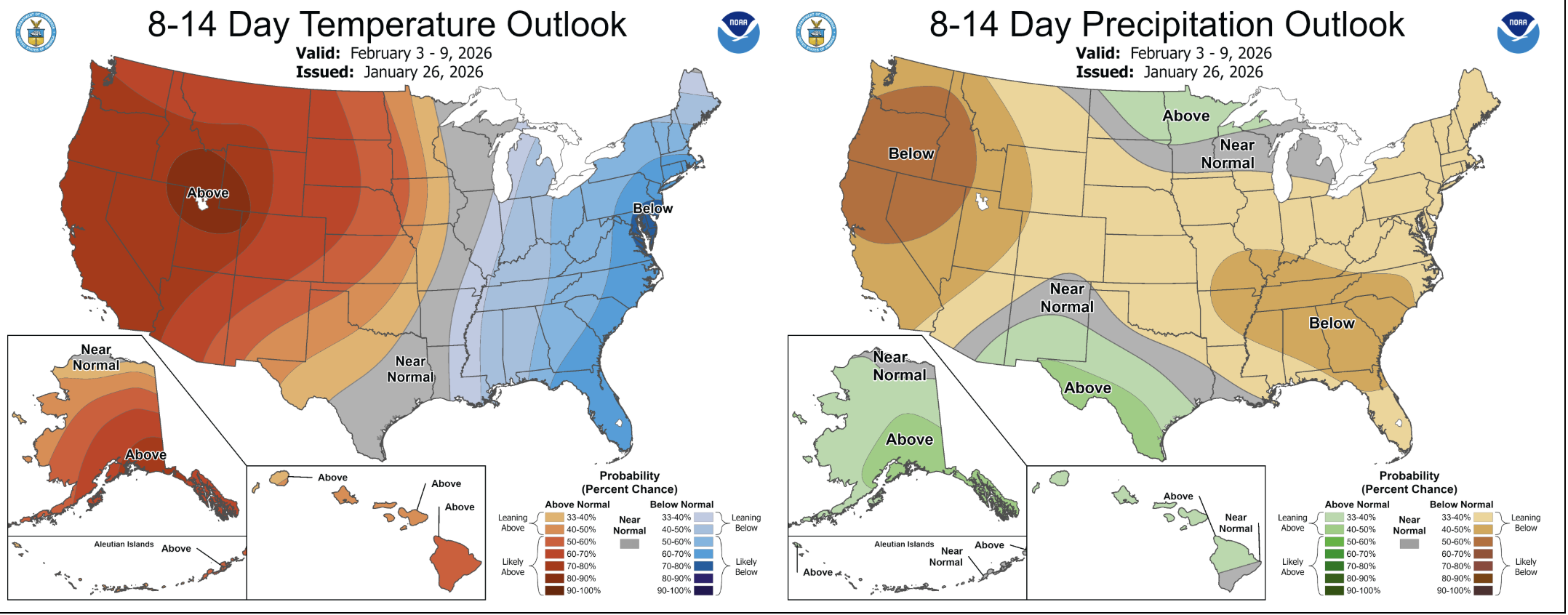
And then as I wrote on Monday, the long range models suggest we revert back to dry and very mild after Monday’s rain passes with high temperatures possibly reaching 60+ degrees by the middle of next week. The 8-14 day outlooks are just… Meh.