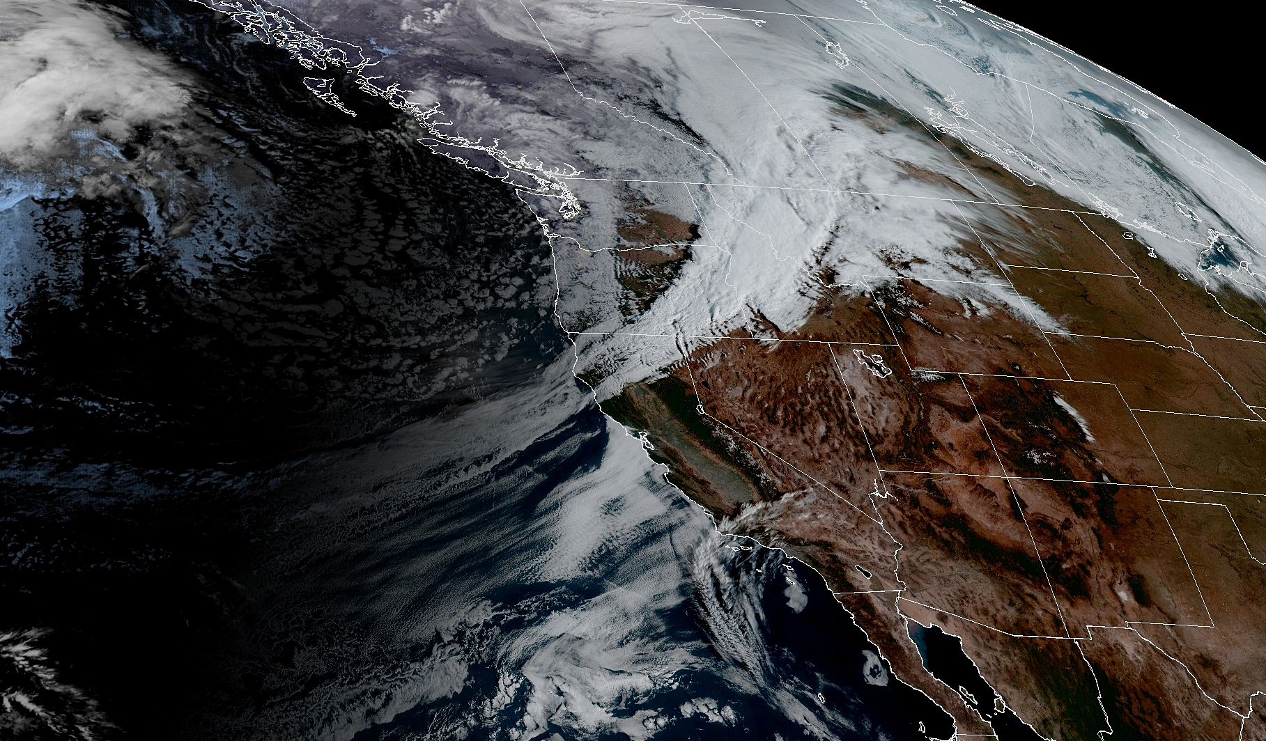
GOES 18 Satellite Image morning of Oct. 19, 2025. (NOAA / CIRA / RAAM-B)
First off, an apology to the dogs and all the pet walkers— really, any walkers — out there….
Sunday is going to be one of those days where you think you might be able to sneak a walk in, and then find you chose… poorly. Cool, unstable air is pouring in after a decent front swept through last night and that’s a recipe for heavy showers mixed in with bursts of sunshine — “fool’s gold.”
Already, my sister is asking when would be a good time to walk the dogs today. The best answer I can give her is… “?”
But even more un-dog-walking friendly — or un human-walking friendly if your stroll includes a stroller or just yourself — is that there is a risk of thunderstorms through the day.
Overall, the thunderstorms should be like “regular” Seattle-area kind — some lightning, bursts of heavy rain, maybe some small hail. Some of the short-term, high resolution models are picking up on a decent amount of wind shear around — where the wind direction veers with height — that could add a little spin to the storms.
That could maybe bring a sporadic funnel cloud report but overall not really like a severe weather pattern. Vast majority of the showers today will just be bursts of rain that make you wonder what just happened to that sun break that was here 30 seconds ago…
The showers and thunderstorms will calm and fade late this evening into the overnight and we’ll dry out. Monday and Tuesday look calm – maybe a few sprinkles Tuesday as an incoming weak front shreds apart before it really gets here.
The next front is inbound during the second half of Wednesday but this one is pretty tame — just some periods of light rain into Thursday.
It’s still Friday into Saturday and then again into Sunday that we’re keeping an eye on for the next notable weather days. We’re watching for a potential atmospheric river-type storm event tFriday that could bring some heavy rains and some gusty winds and maybe a following storm into Sunday.
The latest models have faded back a little on the potential impacts — still rainy and windy Friday but maybe not quite as wet as the initial long range models were thinking — at least for around here.
Earlier it had the rain stalling over the region but now it’s looking a bit more progressive. It may end up somewhat a repeat of the script of this current weekend just maybe a notch wetter and breezier. Models are still all over the place for ideas on next Sunday as far as maybe more rain and/or wind so we’ll keep refreshing those maps.
This just in: My sister made it out in the brief dry slot it took me to write this. May you all have similar luck with the rain lottery today!
Scott, thank you for this post. The National Weather Service lightning safety website says that you can consider the lightning danger ‘over’ 30 minutes after the last sound of thunder. I am wondering if you would consider including your thoughts on lightning safety in some future blog post. I respect your use of good science, and I respect ‘how you express things.’