Multiple atmospheric rivers remain in the cards for West Coast through mid-January
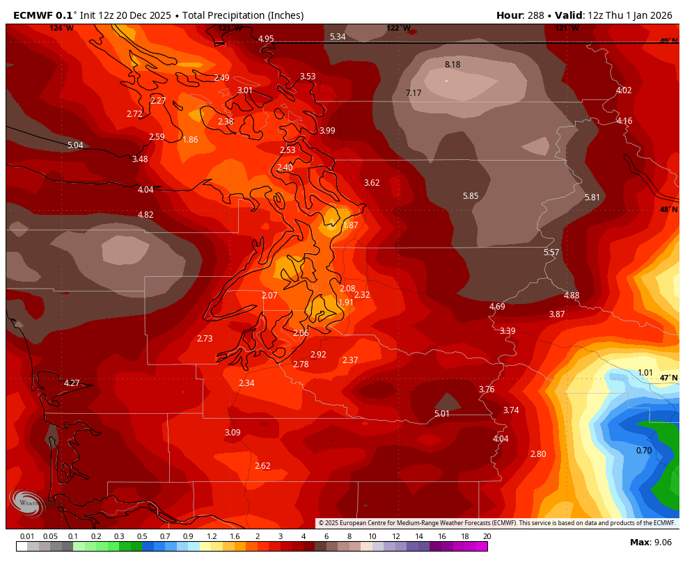
Total Predicted Rain Through Dec. 31
I don’t know what might be on your list this holiday season, but I can probably guess an item that’s not on it:
More rain.
However, it seems more is in the cards.
NOAA’s Climate Prediction Center issued a long range outlook that indicates the West Coast will remain under the barrage of atmospheric rivers not just for the next week, but well into the start of 2026.
“Long-duration Atmospheric River Pattern Continues Across the West” their banner reads.
High pressure in the Bering Sea and corresponding low pressure stuck in the northeastern Pacific will keep a potent jet stream aimed right at us.
The storms in the short term are focusing their brunt of precipitation into California but that “hose” looks to return north to the Pacific Northwest toward the end of the week.
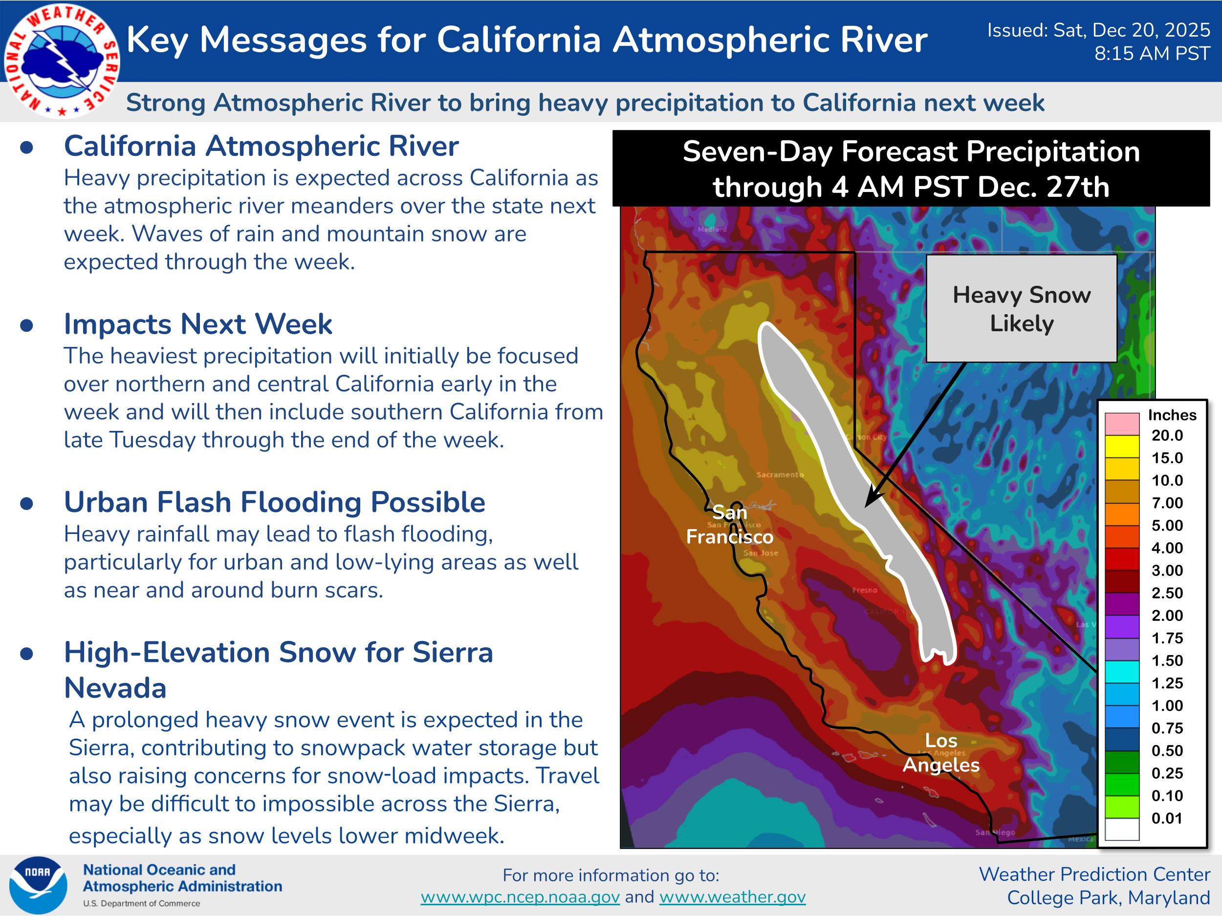
NOAA is calling for a high risk (>60% chance ) of heavy rains from Dec. 27-29, and then a moderate risk of heavy rains extending into Jan. 2 That doesn’t mean it’ll rain non stop those periods, just that’s the primary window for storms. “Flooding is possible from the Pacific Northwest to Northern California,” the NWS said.

In addition, there is a moderate risk of high winds in that later period.
But it doesn’t end there. The 3-4 week outlook spanning Jan. 3-16 remains very wet across the Pacific Northwest. “Above-normal precipitation is likely for the Pacific Northwest and northern Rockies Jan. 3-16,” NOAA said.
In the interim for Christmas week, the weather in the lowlands will remain benign with frequent showers but nothing impactful as far as rain totals or wind gusts.
Snow levels will remain at or below Snoqualmie Pass levels through the week. The snowiest periods besides Saturday look to be late Sunday and again later Monday. If you need a day to get over, Tuesday might be the best, though still snow showers expected.
When will have an update about the possible wind event in the south sound area?