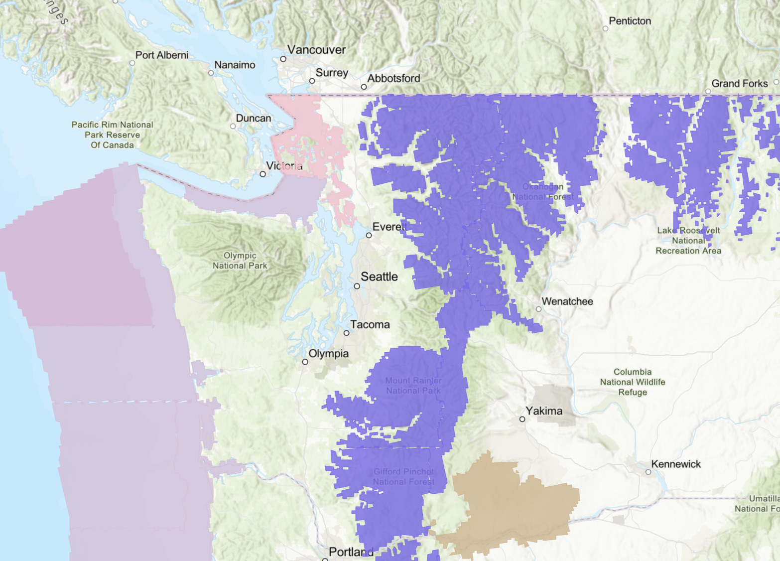
Winter Alerts for Oct. 12, 2025 (Purple = Winter Weather Advisory) Image: NOAA
A couple weeks ago it was 75. Now we’re talking snow alerts!?
At least for the Cascades, it’s true. A chilly low pressure system dropping out of B.C. Sunday will not only make it cooler than it was Sunday, but it will drop snow levels down to their lowest levels of the season — about 3,500-4,000 feet. And there’s plenty of moisture, so you know what that means…
A Snow Advisory — our first of hopefully many – is in effect for much of the Cascades above 4,000 feet Sunday into early Monday. The bulk of the snow will be up along Mount Baker where 10+ inches could fall. But even Stevens Pass could get a few inches. (Snoqualmie Pass will be just rain or maybe a slushy mix at best but just wet roads.)
It’s more noteworthy for being the first of the year than being truly impactful. The main worries are just in case people want to go hiking or climbing in the higher elevations, be ready for winter, not early fall. The higher-than-Stevens mountain passes could also get impactful amounts of snow. By mid-December this will be routine. (Actually, this pattern in mid-December might have been a decent lowland snow chance. Maybe it’s a practice run?)
For the lowlands, it just setting up Sunday to be a chilly and occasionally wet day with highs only in the mid 50s.
FRASER WINDS… IN OCTOBER? (UPDATED)
What will be a bit unusual is as this storm drops out to the south, it’s going to steal another page from winter’s playbook and actually bring a few hours of a gusty north wind out of the Fraser River Valley into Bellingham and Whactom County and across the San Juans.
In fact, now a Wind Advisory is in effect from Sunday evening into early Monday morning for Whatcom County for northeast wind gusts to 45 mph.
This is more a staple of when we get our arctic blasts in the heart of winter and not just wet days in mid-October.
It’s still way too early on the calendar and temperature are way too mild, both in BC and here, for that wind to be TOO cold but it’ll add to the chill, both in bring a little cooler air and adding a bit of wind chill. It may only feel in the upper 40s up there for much of Sunday.
HOW ABOUT A CHILLY BUT SUNNY AUTUMN DAY? 😎
The rain and clouds will push of to the south as that low pressure center drops down the coast and heads for Northern California. But the Fraser wind punch will set up a rather chilly and crisp Monday through Wednesday with sunshine but highs struggling to get out of the 50s and morning lows in the upper 30s to low 40s. Already dreaming up my morning latte orders.
More typical rainy autumn weather returns for the back half of the week into the weekend. Seattle’s “stormy” season usually starts around the third week of October and while there isn’t anything super stormy out there so far, the long range pattern is looking like an active, wetter pattern will be talking hold, right on cue. Maybe we’ll get our second, third, and beyond mountain snow alerts for the season too?