April in February: Near record-warmth in Seattle before we finally cool off again
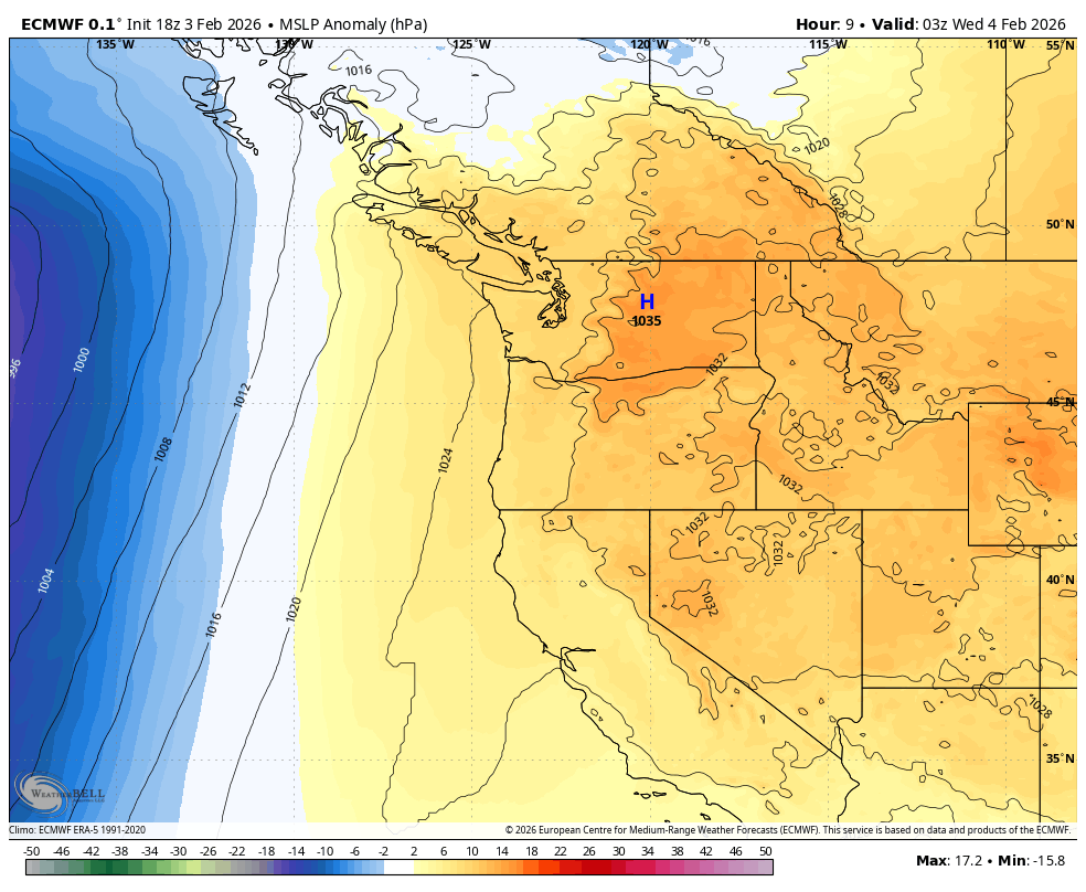
Pressure anomaly for Wednesday across West Coast.
Winter essentially skipped over much of January. Is it about to do the same for February? It’s certainly taking the first week off…
High pressure is one again building into the Pacific Northwest, only this time it’s going to bring the warmest weather we’ve seen in nearly three months.
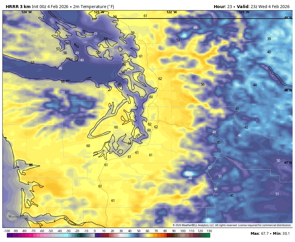
Wednesday is shaping up to be the warmest of the warm stretch, with highs reaching 60 or perhaps a little over around the Seattle area. That would make it the warmest day since Nov. 9 —when we were all starting to panic over where to get our turkeys and who was going to have to be the one to break it to Uncle Earl that there was not going to be enough room at the big Thanksgiving table and he has been relegated to the kids table.*
(*NO this was not a hint at a true personal story. I don’t have an Uncle Earl. Also, the kids eat on the floor.**)
(**NO the kids don’t actually eat on the floor. They briefly eat standing up in the kitchen before racing off to their bedrooms to watch YouTube or something…***)
(*** NO the kids don’t actually shun the family to watch YouTube on Thanksgiving. It’s TikTok.)
Anyway, Wednesday’s highs are closing in on the record for the day (63 set in 2009) but no matter, it’s going to be a day where maybe shorts aren’t quite so zany of an idea****
(**** YES, it’s still a zany idea.)
Warm air hangs around Thursday and Friday with partly to mostly sunny skies after some patchy fog with highs in the upper 50s.
Do you know what we call 59 degrees in February? April.*****
(*****- NO, It’s still legally February. Don’t give the tax folks a heart attack.)
TAXES? WORSE DON’T MAKE ME HAVE TO MOW MY LAWN YET! WHEN DOES APRIL BECOME FEBRUARY?
I have good news! The long range models are indicating a shift in the weather pattern to cooler weather!
OH LOOK SCOTT’S SAYING COLDER WEATHER IN THE LONG RANGE FORECAST! I HAVE TOTALLY NEVER HEARD THIS BEFORE THIS WINTER (;))
I know, cold air is always 7-10 days away. It feels like in May I’ll still be saying “Well it’s hot now, but hey look the Euro model says it might snow in 8-10 days!”
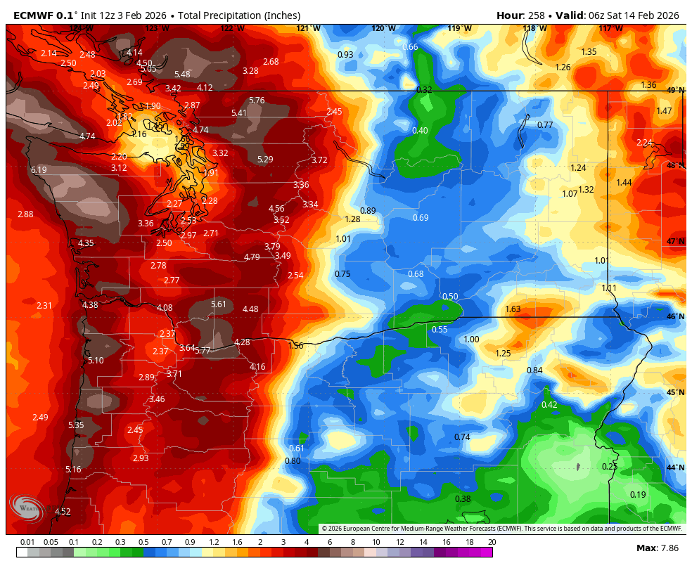
But so far, so good on the current shift. It’s not radical cooling, but enough that it should start bringing snow back to the snow-starved mountains.
The first rain arrives late Friday and it’s a wet and still semi-mild Saturday, but subsequent weather systems should get gradually cooler.
So far, no big arctic outbreak that would portend widespread lowland snow, but next week does look generally cool and wet with highs in the 40s in the lowlands and snow starting to re-pile up in the mountains.
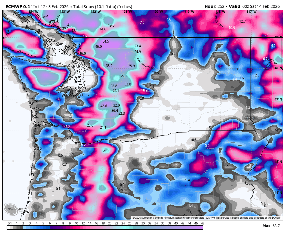
Skiers might want to start saving up some of the hooky days you’ve totally not used this winter so far for maybe the end of next week. Come to think of it, maybe I should send Earl a lift ticket as an apology*******
(****** HAD I ACTUALLY MADE HIM SIT AT THE KIDS TABLE AT THANKSGIVING….which I totally did not do… so… no worries.
Also: 6 asterisks? Really?*******
(******* HA HA NOW YOU MADE IT SEVEN….)
If I’m interpreting the ECMWF map correctly, it looks like parts of the lowlands, including Aberdeen, Shelton, Port Angeles, Puyallup, Bellingham, and especially Longview and Mount Vernon, could see lowland snow in the next week and a half. Am I misinterpreting the map, or is the possibility of lowland snow in these communities really on the table? Many thanks!